Latitude: 50.9519 / 50°57'6"N
Longitude: -2.7544 / 2°45'15"W
OS Eastings: 347101
OS Northings: 117209
OS Grid: ST471172
Mapcode National: GBR MH.NCZD
Mapcode Global: FRA 563L.JQG
Plus Code: 9C2VX62W+Q6
Entry Name: Stoke Sub Hamdon Methodist Church
Listing Date: 27 October 1987
Grade: II
Source: Historic England
Source ID: 1116987
English Heritage Legacy ID: 442473
ID on this website: 101116987
Location: Stoke sub Hamdon, Somerset, TA14
County: Somerset
District: South Somerset
Civil Parish: Stoke sub Hamdon
Built-Up Area: Stoke sub Hamdon
Traditional County: Somerset
Lieutenancy Area (Ceremonial County): Somerset
Tagged with: Protestant church building
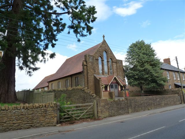
ST4717 STOKE SUB HAMDON CP WEST STREET (North side) 6/338 Stoke sub Hamdon Methodist Church - - II Methodist Church. 1909. Ham stone ashlar facade, coursed rubble with dressings to sides and rear; plain clay tiled roof behind front coped and stepped gable. In a simple Art-Nouveau style. Front gable has pilasters carried above roof line with chequer ornament, moulded coping with cross- finial; below a projecting timber-framed and plain tiled porch between two raked buttress walls having flat tops with ball finials, with pair wide part-glazed doors under timber gable, with small-pane casement sidelights; above, a group of 3 lancet windows, the centre taller, with impost string and shared arched label, the windows having Art-Nouveau leading. On side elevations pair plain chamfered windows under eaves having exposed rafter ends, leaded to match. A 3-bay extension to match at north end, also a flat roofed extension to east, probably of same date. Interior not seen. Well detailed example of type, apparently unaltered. (VCH Vol III, 1974).
Listing NGR: ST4710117209
External links are from the relevant listing authority and, where applicable, Wikidata. Wikidata IDs may be related buildings as well as this specific building. If you want to add or update a link, you will need to do so by editing the Wikidata entry.


Other nearby listed buildings