Latitude: 51.4124 / 51°24'44"N
Longitude: -0.8298 / 0°49'47"W
OS Eastings: 481482
OS Northings: 168808
OS Grid: SU814688
Mapcode National: GBR D7R.F13
Mapcode Global: VHDX2.KRPL
Plus Code: 9C3XC56C+X3
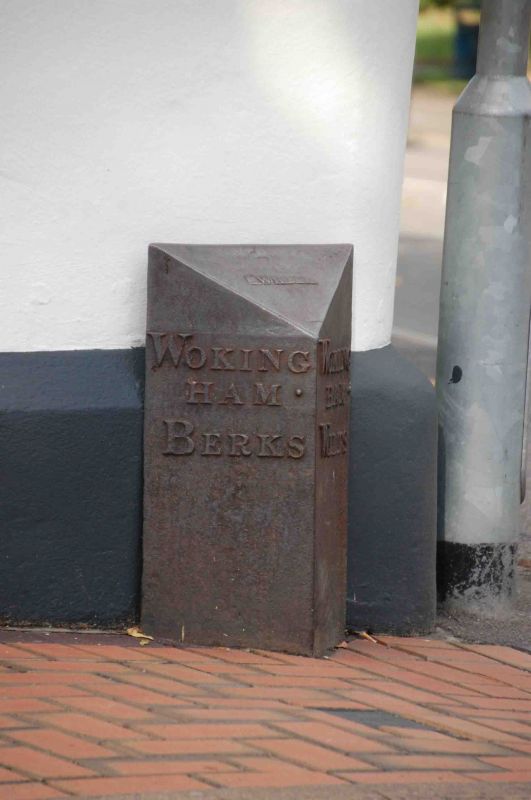
Entry Name: Boundary Marker at South West Corner of No 6 Wiltshire Road
Listing Date: 15 July 1987
Grade: II
Source: Historic England
Source ID: 1117999
English Heritage Legacy ID: 41741
ID on this website: 101117999
Location: Wokingham, Berkshire, RG40
County: Wokingham
Civil Parish: Wokingham
Built-Up Area: Wokingham
Traditional County: Berkshire
Lieutenancy Area (Ceremonial County): Berkshire
Church of England Parish: Wokingham
Church of England Diocese: Oxford
Tagged with: Building Boundary marker
WOKINGHAM ROSE STREET SU 8168 NW (North west side) 18/64 Boundary marker at south west corner of No.6 Wiltshire Road G.V. II Boundary marker. Early C19. Cast iron. Triangular plan with sloping top. Raised lettering which reads on the left side:- WOKINGHAM BERKS on the right side WOKINGHAM WILTS and on the top WILDER Formerly marked the boundary between the county of Berkshire and that part of the county of Wiltshire which included part of Wokingham until 1845. Removed from its original position in Cross Street in late C20, when the construction of Mulberry Court altered the line of that street.
Listing NGR: SU8148268808
External links are from the relevant listing authority and, where applicable, Wikidata. Wikidata IDs may be related buildings as well as this specific building. If you want to add or update a link, you will need to do so by editing the Wikidata entry.


Other nearby listed buildings