Approximate Location Map
Large Map »
Latitude: 51.3605 / 51°21'37"N
Longitude: -0.9865 / 0°59'11"W
OS Eastings: 470664
OS Northings: 162863
OS Grid: SU706628
Mapcode National: GBR B5G.PDF
Mapcode Global: VHDXC.V2CD
Plus Code: 9C3X9267+5C
Entry Name: Stanfordend Bridge
Listing Date: 26 January 1967
Grade: II
Source: Historic England
Source ID: 1118058
English Heritage Legacy ID: 41583
ID on this website: 101118058
Location: Stanford End, Wokingham, Berkshire, RG27
County: Wokingham
Civil Parish: Swallowfield
Traditional County: Berkshire
Lieutenancy Area (Ceremonial County): Hampshire
Church of England Parish: Swallowfield
Church of England Diocese: Oxford
Tagged with: Bridge
SWALLOWFIELD CHEQUER LANE
SU 76 SW
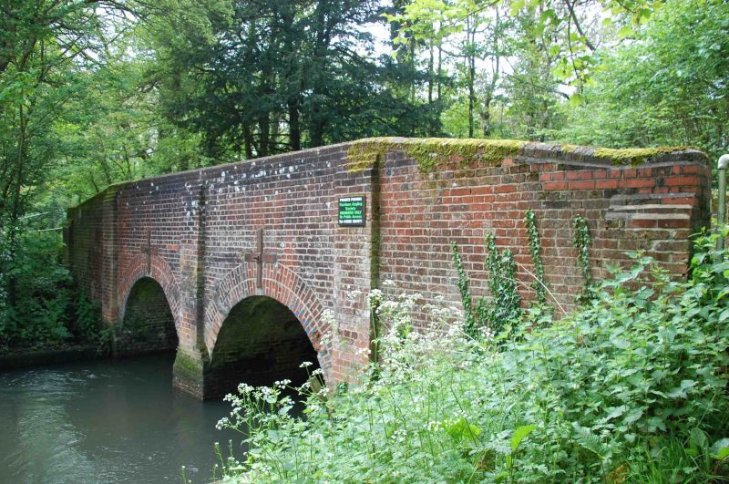
Stanford End
11/12 Stanfordend Bridge
26.1.67
II
Road bridge over the River Loddon. Dated LR Brick. 2 small arches
divided by buttresses, plain parapet 17 87
and coping.
Listing NGR: SU7066462863
External links are from the relevant listing authority and, where applicable, Wikidata. Wikidata IDs may be related buildings as well as this specific building. If you want to add or update a link, you will need to do so by editing the Wikidata entry.


Other nearby listed buildings
