Latitude: 50.6876 / 50°41'15"N
Longitude: -2.1243 / 2°7'27"W
OS Eastings: 391312
OS Northings: 87560
OS Grid: SY913875
Mapcode National: GBR 21G.XBG
Mapcode Global: FRA 67F8.B6Q
Plus Code: 9C2VMVQG+37
Entry Name: West Mill
Listing Date: 8 April 1976
Grade: II
Source: Historic England
Source ID: 1119936
English Heritage Legacy ID: 108090
ID on this website: 101119936
Location: Dorset, BH20
County: Dorset
Civil Parish: Wareham Town
Built-Up Area: Wareham
Traditional County: Dorset
Lieutenancy Area (Ceremonial County): Dorset
Church of England Parish: Wareham Lady St Mary
Church of England Diocese: Salisbury
Tagged with: Mill
1.
5190 WAREHAM COMMON
West Mill
SY 9187 5/205
II GV
2.
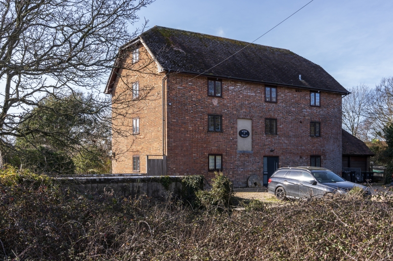
Mid C19. Brown brick. Half-hipped tile roof. 3 storeys and attics. 3 ranges
of fixed windows with glazing bars. East elevation has planked stable door on
ground floor and loading door on 1st floor. 1 window range in each end elevation,
including window in attic.
West Mill, West Mill Farm House and the bridges over the River Piddle form a group.
Listing NGR: SY9131287560
External links are from the relevant listing authority and, where applicable, Wikidata. Wikidata IDs may be related buildings as well as this specific building. If you want to add or update a link, you will need to do so by editing the Wikidata entry.


Other nearby listed buildings