Approximate Location Map
Large Map »
Latitude: 50.6878 / 50°41'16"N
Longitude: -2.1239 / 2°7'26"W
OS Eastings: 391342
OS Northings: 87583
OS Grid: SY913875
Mapcode National: GBR 21G.XG8
Mapcode Global: FRA 67F8.BC0
Plus Code: 9C2VMVQG+4C
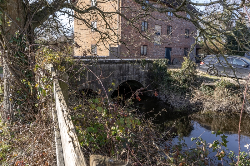
Entry Name: Bridge to South of West Mill over River Piddle
Listing Date: 8 April 1976
Grade: II
Source: Historic England
Source ID: 1119938
English Heritage Legacy ID: 108092
ID on this website: 101119938
Location: Dorset, BH20
County: Dorset
Civil Parish: Wareham Town
Built-Up Area: Wareham
Traditional County: Dorset
Lieutenancy Area (Ceremonial County): Dorset
Church of England Parish: Wareham Lady St Mary
Church of England Diocese: Salisbury
Tagged with: Bridge
1.
5190 WAREHAM COMMON
Bridge to south of
West Mill over
River Piddle
SY 9187 5/207
II GV
2.
Mid C19. Brown brick. 2 segmental arches and cutwater. Brick parapet with stone
coping.
West Mill, West Mill Farm House and the bridges over the River Piddle form a group.
Listing NGR: SY9134287583
External links are from the relevant listing authority and, where applicable, Wikidata. Wikidata IDs may be related buildings as well as this specific building. If you want to add or update a link, you will need to do so by editing the Wikidata entry.


Other nearby listed buildings
