Latitude: 51.1979 / 51°11'52"N
Longitude: 0.2757 / 0°16'32"E
OS Eastings: 559094
OS Northings: 146754
OS Grid: TQ590467
Mapcode National: GBR MP0.Y82
Mapcode Global: VHHQ6.Q5L1
Plus Code: 9F3257XG+47
Entry Name: 157, High Street
Listing Date: 20 January 1972
Grade: II
Source: Historic England
Source ID: 1121139
English Heritage Legacy ID: 178684
ID on this website: 101121139
Location: The Park, Tonbridge and Malling, Kent, TN9
County: Kent
District: Tonbridge and Malling
Electoral Ward/Division: Medway
Parish: Non Civil Parish
Built-Up Area: Tonbridge
Traditional County: Kent
Lieutenancy Area (Ceremonial County): Kent
Church of England Parish: Tonbridge St Peter and St Paul
Church of England Diocese: Rochester
Tagged with: Building
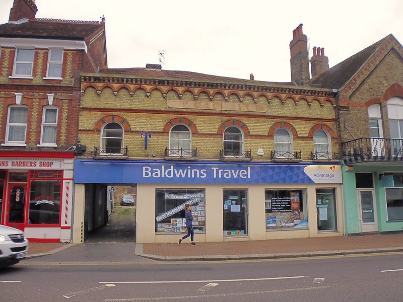
1. HIGH STREET
1732 (East Side)
No 157
TQ 5946 NW 3/115
II
2.
Building of probably C16 origin, but with C19 brick front. Heavy timber
framing and crown post in attic. Early C19 assembly room flanking former
inn yard to which is carriage door access. This building is listed solely
on account of its interior features.
Listing NGR: TQ5909646753
External links are from the relevant listing authority and, where applicable, Wikidata. Wikidata IDs may be related buildings as well as this specific building. If you want to add or update a link, you will need to do so by editing the Wikidata entry.


Other nearby listed buildings