Latitude: 51.1989 / 51°11'55"N
Longitude: 1.2609 / 1°15'39"E
OS Eastings: 627912
OS Northings: 149460
OS Grid: TR279494
Mapcode National: GBR W0M.MMQ
Mapcode Global: VHLH3.S4Y8
Plus Code: 9F3357X6+G9
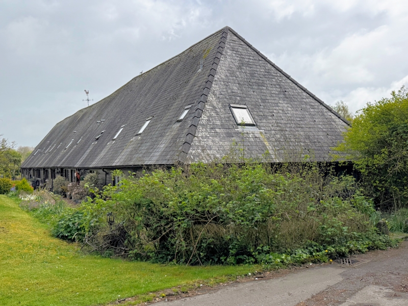
Entry Name: Barn About 40 Metres North West of Eythorne Court Eythorne Barn
Listing Date: 3 November 1986
Grade: II
Source: Historic England
Source ID: 1121889
English Heritage Legacy ID: 177899
ID on this website: 101121889
Location: Lower Eythorne, Dover, Kent, CT15
County: Kent
District: Dover
Civil Parish: Eythorne
Built-Up Area: Eythorne
Traditional County: Kent
Lieutenancy Area (Ceremonial County): Kent
Tagged with: Barn
This list entry was subject to a Minor Amendment on 20 April 2026 to amend the name and address and reformat the text to current standards
TR 24 NE
4/38
EYTHORNE
SHEPHERDSWELL ROAD
Eythorne Court Barn
(Formerly listed as Barn about 40 metres north-west of Eythorne Court (Eythorne Barn)
3.11.86
GV
II
Barn. C16 and mid C18. Timber framed and weatherboarded with side elevations of painted brick with slated roof. Half-hipped roof to right with three raking mid-streys.
Interior: two periods of building, to left (south) four bays with aisles and terminal outshot with passing shores to arcade posts and clasped purlin roof. To north, seven bays with aisles, and clasped purlin roof. Full hip to the left.
Listing NGR: TR2789549395
External links are from the relevant listing authority and, where applicable, Wikidata. Wikidata IDs may be related buildings as well as this specific building. If you want to add or update a link, you will need to do so by editing the Wikidata entry.


Other nearby listed buildings