Latitude: 51.888 / 51°53'16"N
Longitude: 0.8984 / 0°53'54"E
OS Eastings: 599554
OS Northings: 225018
OS Grid: TL995250
Mapcode National: GBR SN4.RXL
Mapcode Global: VHKFZ.JT91
Plus Code: 9F32VVQX+59
Entry Name: 12-14, Sir Isaac's Walk
Listing Date: 24 February 1950
Grade: II
Source: Historic England
Source ID: 1123517
English Heritage Legacy ID: 117193
ID on this website: 101123517
Location: Colchester, Essex, CO1
County: Essex
District: Colchester
Electoral Ward/Division: Castle
Parish: Non Civil Parish
Built-Up Area: Colchester
Traditional County: Essex
Lieutenancy Area (Ceremonial County): Essex
Church of England Parish: Colchester St Peter
Church of England Diocese: Chelmsford
Tagged with: Building
1. SIR ISAAC'S WALK 995 Nos 12 to 14 (consec) TL 9925 SE 5/206 24.2.50.
II
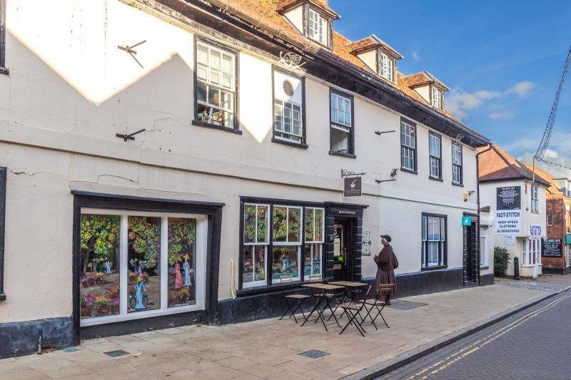
2. Early C18 features, 2 storeys and attics, 5 hipped dormers, the roofs tiled. Coved plaster eaves cornice with date 1711, 9-window range of double hung sashes with glazing bars, 3 doorways with rusticated architraves.
Listing NGR: TL9955425018
External links are from the relevant listing authority and, where applicable, Wikidata. Wikidata IDs may be related buildings as well as this specific building. If you want to add or update a link, you will need to do so by editing the Wikidata entry.


Other nearby listed buildings