Approximate Location Map
Large Map »
Latitude: 51.8877 / 51°53'15"N
Longitude: 0.8979 / 0°53'52"E
OS Eastings: 599519
OS Northings: 224983
OS Grid: TL995249
Mapcode National: GBR SN4.RS9
Mapcode Global: VHKFZ.JT08
Plus Code: 9F32VVQX+34
Entry Name: 41-44, St John's Street
Listing Date: 2 December 1971
Grade: II
Source: Historic England
Source ID: 1337768
English Heritage Legacy ID: 117182
ID on this website: 101337768
Location: Colchester, Essex, CO2
County: Essex
District: Colchester
Electoral Ward/Division: Castle
Parish: Non Civil Parish
Built-Up Area: Colchester
Traditional County: Essex
Lieutenancy Area (Ceremonial County): Essex
Church of England Parish: Colchester St Botolph with Holy Trinity (LEP)
Church of England Diocese: Chelmsford
Tagged with: Building
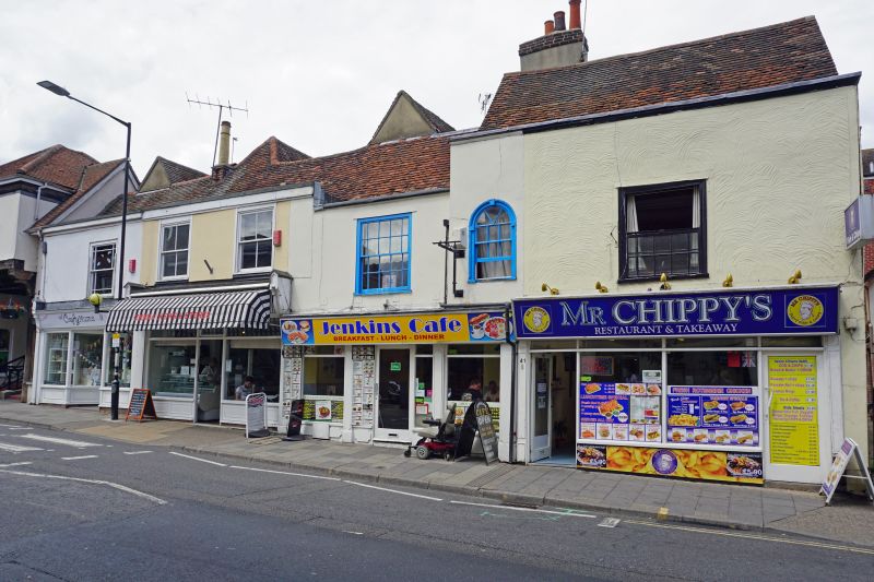
1. ST JOHN'S STREET
995 (North Side)
Nos 41 to 44 (consec)
TL 9924 lIE 9/521
II GV
2.
C17 or earlier. Timber-framed, modern shop fronts below, rendered and
painted above. 2 storeys, 6 windows to range, 4 sashes No 42 has a
round-headed one, No 43 has 2 casements. Old rear wings. Old tile
roof.
Nos 35 to 48 (consec) form a group
Listing NGR: TL9949924981
External links are from the relevant listing authority and, where applicable, Wikidata. Wikidata IDs may be related buildings as well as this specific building. If you want to add or update a link, you will need to do so by editing the Wikidata entry.


Other nearby listed buildings
