Approximate Location Map
Large Map »
Latitude: 51.1037 / 51°6'13"N
Longitude: 0.4013 / 0°24'4"E
OS Eastings: 568212
OS Northings: 136561
OS Grid: TQ682365
Mapcode National: GBR NRP.L9N
Mapcode Global: VHJN3.XJ08
Plus Code: 9F324C32+FG
Entry Name: Group of Four Chest Tombs About 5 to 20 Metres South of Church of St Mary
Listing Date: 10 October 1989
Grade: II
Source: Historic England
Source ID: 1123704
English Heritage Legacy ID: 169975
ID on this website: 101123704
Location: St Mary's Church, Lamberhurst, Tunbridge Wells, Kent, TN3
County: Kent
District: Tunbridge Wells
Civil Parish: Lamberhurst
Traditional County: Kent
Lieutenancy Area (Ceremonial County): Kent
Church of England Parish: Lamberhurst St Mary
Church of England Diocese: Rochester
Tagged with: Chest tomb
LAMBERHURST CHURCH ROAD
TQ 63 NE
(south side)
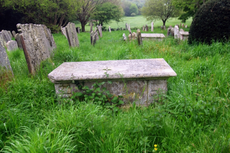
3/138 Group of four chest tombs
about 5 to 20 metres
south of church of St.Wary
GV II
Group of four chest tombs. Early to mid C18. Three nearly identical chests with
wave moulded corner piers and simple panelled sides and with moulded top slabs.
Themost southerly chest later in character with moulded panels, the corners
chamfered, and vase shaped corner piers.
Listing NGR: TQ6781936707
External links are from the relevant listing authority and, where applicable, Wikidata. Wikidata IDs may be related buildings as well as this specific building. If you want to add or update a link, you will need to do so by editing the Wikidata entry.


Other nearby listed buildings
