Approximate Location Map
Large Map »
Latitude: 51.6417 / 51°38'30"N
Longitude: -0.7905 / 0°47'25"W
OS Eastings: 483794
OS Northings: 194348
OS Grid: SU837943
Mapcode National: GBR D52.4YR
Mapcode Global: VHDVY.7ZZV
Plus Code: 9C3XJ6R5+MR
Entry Name: Garden Wall to Floras Temple
Listing Date: 28 June 1973
Grade: II
Source: Historic England
Source ID: 1125122
English Heritage Legacy ID: 46153
ID on this website: 101125122
Location: Buckinghamshire, HP12
County: Buckinghamshire
Civil Parish: West Wycombe
Built-Up Area: High Wycombe
Traditional County: Buckinghamshire
Lieutenancy Area (Ceremonial County): Buckinghamshire
Church of England Parish: West Wycombe
Church of England Diocese: Oxford
Tagged with: Wall
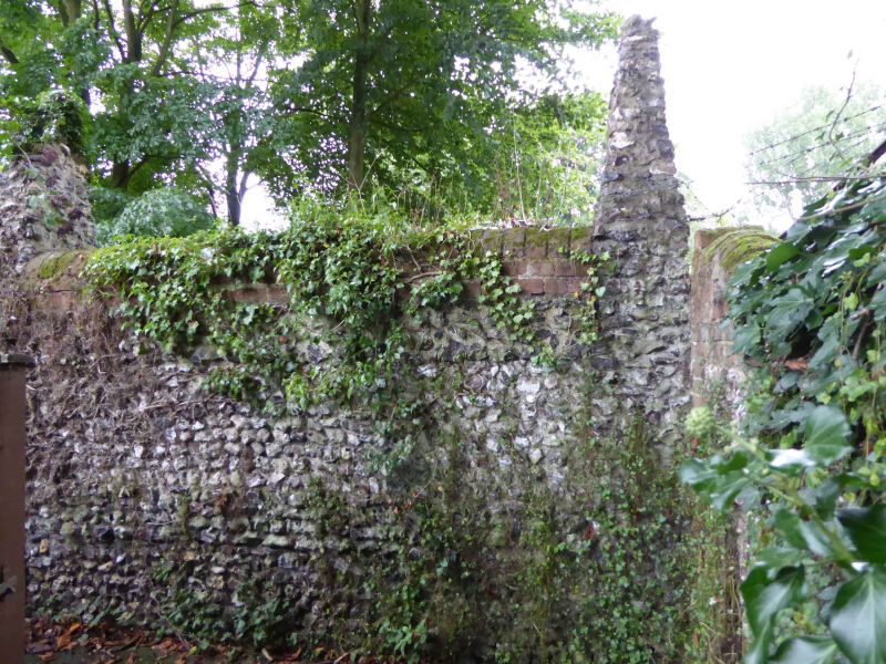
WEST WYCOMBE
1.
963
Garden Wall to
Flora's Temple
SU 8394 10/341
II
2.
Late C18 flint rubble and red brick garden wall with small obelisk pinnacles,
brick coping.
Listing NGR: SU8379494348
External links are from the relevant listing authority and, where applicable, Wikidata. Wikidata IDs may be related buildings as well as this specific building. If you want to add or update a link, you will need to do so by editing the Wikidata entry.


Other nearby listed buildings
