Approximate Location Map
Large Map »
Latitude: 51.638 / 51°38'16"N
Longitude: -0.788 / 0°47'16"W
OS Eastings: 483974
OS Northings: 193942
OS Grid: SU839939
Mapcode National: GBR D52.CKW
Mapcode Global: VHDW4.9393
Plus Code: 9C3XJ6Q6+6R
Entry Name: Farm Buildings at Park Farm
Listing Date: 9 January 1954
Grade: II
Source: Historic England
Source ID: 1310540
English Heritage Legacy ID: 46149
ID on this website: 101310540
Location: Sands, Buckinghamshire, HP12
County: Buckinghamshire
Civil Parish: West Wycombe
Traditional County: Buckinghamshire
Lieutenancy Area (Ceremonial County): Buckinghamshire
Church of England Parish: West Wycombe
Church of England Diocese: Oxford
Tagged with: Agricultural structure
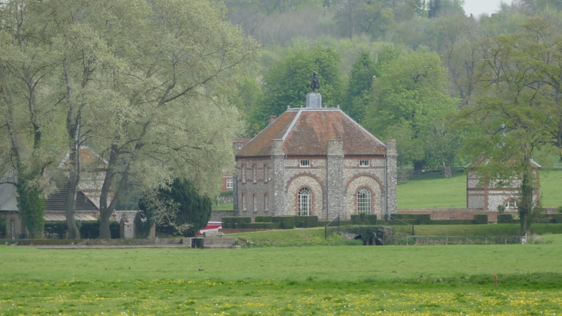
WEST WYCOMBE
1.
963
Farm Buildings at
Park Farm
(Formerly listed as
Park Farmhouse)
SU 8393 10/10
SU 8493 10/10 9.1.54.
II
2.
Late C18. Flint rubble, red brick dressings, old tiled roofs. 2 storeys
with 3 storeys either end of west front, brick floor bands, brick dentil
cornice.
Listing NGR: SU8397493942
External links are from the relevant listing authority and, where applicable, Wikidata. Wikidata IDs may be related buildings as well as this specific building. If you want to add or update a link, you will need to do so by editing the Wikidata entry.


Other nearby listed buildings
