Approximate Location Map
Large Map »
Latitude: 51.6375 / 51°38'15"N
Longitude: -0.7869 / 0°47'12"W
OS Eastings: 484047
OS Northings: 193890
OS Grid: SU840938
Mapcode National: GBR D52.CVV
Mapcode Global: VHDW4.93VH
Plus Code: 9C3XJ6Q7+26
Entry Name: Round House
Listing Date: 9 January 1954
Grade: II
Source: Historic England
Source ID: 1332395
English Heritage Legacy ID: 46150
ID on this website: 101332395
Location: Sands, Buckinghamshire, HP12
County: Buckinghamshire
Civil Parish: West Wycombe
Traditional County: Buckinghamshire
Lieutenancy Area (Ceremonial County): Buckinghamshire
Church of England Parish: West Wycombe
Church of England Diocese: Oxford
Tagged with: House
WEST WYCOMBE
1.
963
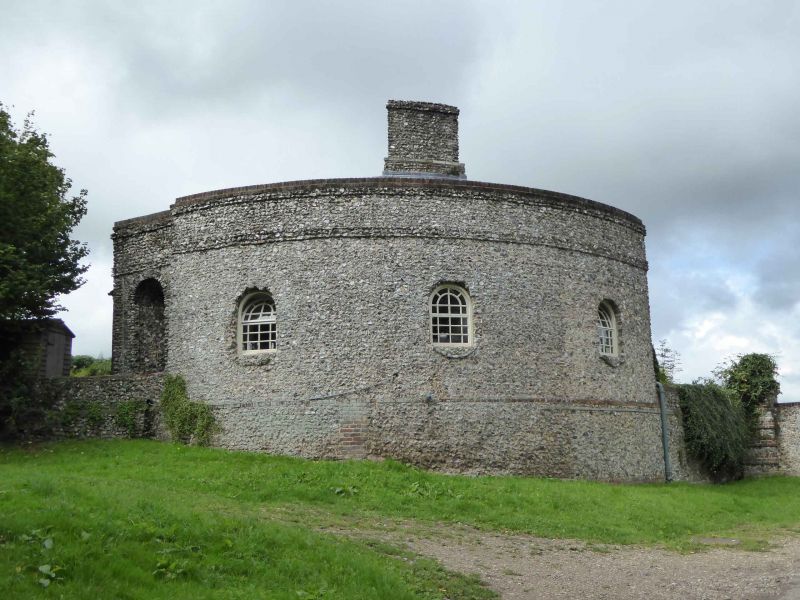
Round House
SU 8493 10/11 9.1.54.
II
2.
Late C18. Flint rubble with parapet, hipped old tiled roof. Quadrant
plan with additions; single storey. East front 2 round headed windows
with glazing bars.
Listing NGR: SU8404793890
External links are from the relevant listing authority and, where applicable, Wikidata. Wikidata IDs may be related buildings as well as this specific building. If you want to add or update a link, you will need to do so by editing the Wikidata entry.


Other nearby listed buildings
