Latitude: 52.3865 / 52°23'11"N
Longitude: 0.2083 / 0°12'29"E
OS Eastings: 550381
OS Northings: 278789
OS Grid: TL503787
Mapcode National: GBR M6L.CH6
Mapcode Global: VHHJC.K8GV
Plus Code: 9F4296P5+H8
Entry Name: Church of St Andrew
Listing Date: 5 February 1952
Grade: II*
Source: Historic England
Source ID: 1127000
English Heritage Legacy ID: 49521
Also known as: St Andrew's Church, Witchford
ID on this website: 101127000
Location: St Andrew's Church, Witchford, East Cambridgeshire, CB6
County: Cambridgeshire
District: East Cambridgeshire
Civil Parish: Witchford
Built-Up Area: Witchford
Traditional County: Cambridgeshire
Lieutenancy Area (Ceremonial County): Cambridgeshire
Church of England Parish: Witchford
Church of England Diocese: Ely
Tagged with: Church building
WITCHFORD MAIN STREET TL 5078 (South Side)
20/31 Church of St Andrew 5.2.52 - II*
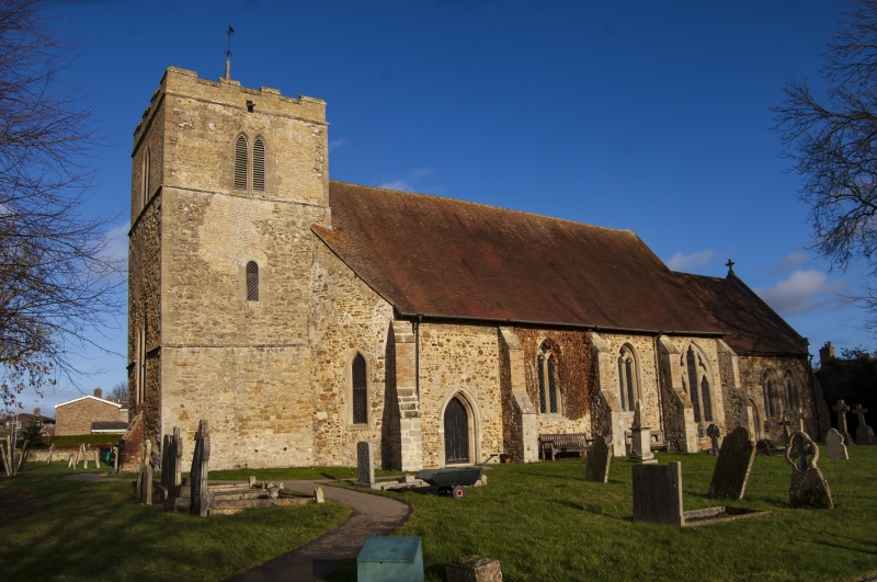
Parish church. C13 west tower, and 1376 nave and chancel. Field and rubblestone and dressed limestone dressings. Plain tiled roof with end parapet to chancel. Plan of west tower, aisleless nave and chancel. Three-stage embattled west tower has C18 gault brick repairs. No plinth and unbuttressed. Dressed limestone quoins. Restored west window of two lights in two centred arches and similar paired lights to bell stage. Nave: Three windows of three cinquefoil lights with Decorated tracery in two centred arch with label. Continuous double chamfered north and south doorways. Nave buttressing has off-set. Canted west walls with single lancet to connect with west tower. The chancel has east window of three lights with Decorated tracery. Interior: C17 staggered butt purlin nave roof. C13 two centred tower arch partly blocked. Chancel arch is two centred and of two chamfered orders, the inner on engaged shaft with moulded capital. Two niches, C14-C15, flank the chancel arch. There is a low side window in the south wall. The font is C13. Limestone. Tapering octagon on a column with splayed lower edge and moulded holdwater base.
Pevsner: Buildings of England, p.504 V.C.H. Cambs. IV
Listing NGR: TL5038178789
External links are from the relevant listing authority and, where applicable, Wikidata. Wikidata IDs may be related buildings as well as this specific building. If you want to add or update a link, you will need to do so by editing the Wikidata entry.


Other nearby listed buildings