Latitude: 52.6439 / 52°38'38"N
Longitude: -0.4445 / 0°26'40"W
OS Eastings: 505345
OS Northings: 306264
OS Grid: TF053062
Mapcode National: GBR FW0.8FC
Mapcode Global: WHGLY.4SMZ
Plus Code: 9C4XJHV4+H6
Entry Name: Queen Elizabeth's Gate
Listing Date: 19 March 1962
Grade: II
Source: Historic England
Source ID: 1127506
English Heritage Legacy ID: 50319
ID on this website: 101127506
Location: Peterborough, Cambridgeshire, PE9
County: City of Peterborough
Civil Parish: Barnack
Traditional County: Northamptonshire
Lieutenancy Area (Ceremonial County): Cambridgeshire
Tagged with: Building
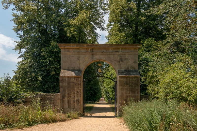
1. 5141 ST MARTINS WITHOUT BURGHLEY PARK Queen Elizabeth's Gate (formerly listed under the Civil Parish of TF 00 NE 2/520 19.3.62 Barnack) II GV 2. Late C18 gate way in form of a plain ashlar wall with moulded round arch with moulded impost and dilapidated entablature. Decorative wrought iron gates with good wrought iron overthrow. Date 1797 and initials scratched on the masonry.
Listing NGR: TF0534506264
External links are from the relevant listing authority and, where applicable, Wikidata. Wikidata IDs may be related buildings as well as this specific building. If you want to add or update a link, you will need to do so by editing the Wikidata entry.


Other nearby listed buildings