Latitude: 51.4548 / 51°27'17"N
Longitude: -2.8269 / 2°49'37"W
OS Eastings: 342637
OS Northings: 173196
OS Grid: ST426731
Mapcode National: GBR JD.MRLN
Mapcode Global: VH7C1.YPCL
Plus Code: 9C3VF53F+W6
Entry Name: Gazebo About 30 Metres North West of Home Farmhouse
Listing Date: 20 January 1986
Grade: II
Source: Historic England
Source ID: 1129134
English Heritage Legacy ID: 33783
ID on this website: 101129134
Location: Walton in Gordano, North Somerset, BS21
County: North Somerset
Civil Parish: Walton-in-Gordano
Traditional County: Somerset
Lieutenancy Area (Ceremonial County): Somerset
Tagged with: Gazebo
ST 47 SW
3/120
WALTON-IN-GORDANO C.P.
PORTISHEAD ROAD (west side)
Gazebo about 30 metres north west of Home Farmhouse
II
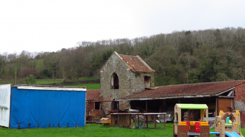
Gazebo. Late C18 with late C19/early C20 shelter sheds attached to each side.
Gazebo in rubble with pantiled roof and limestone raised coped verges; attached
open-fronted shelter sheds in brick, 3 bays each side with double Roman tiled
roof (not of architectural interest). Rectangular gazebo has pointed arched
opening at ground and first floor front and rear, blocked at ground floor rear,
first floor rear retains Y-tracery of Gothic glazing bars, segmental-headed
window opening at upper level of right return. Interior: formerly had upper
floor, segmental-headed fireplace remains at upper level to left, some plain
plasterwork. Home Farmhouse was originally a house (not included in list);
gazebo similar to gazebo at the Manor House (q.v.).
Listing NGR: ST4263773196
External links are from the relevant listing authority and, where applicable, Wikidata. Wikidata IDs may be related buildings as well as this specific building. If you want to add or update a link, you will need to do so by editing the Wikidata entry.


Other nearby listed buildings