Approximate Location Map
Large Map »
Latitude: 51.3641 / 51°21'50"N
Longitude: -2.7635 / 2°45'48"W
OS Eastings: 346942
OS Northings: 163061
OS Grid: ST469630
Mapcode National: GBR JH.T9L5
Mapcode Global: VH88Y.1ZX4
Plus Code: 9C3V967P+MJ
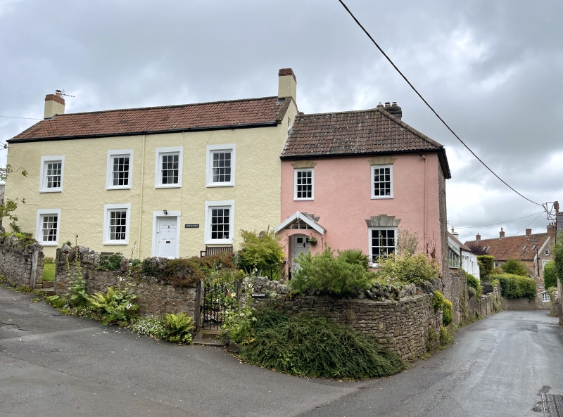
Entry Name: Applegarth
Listing Date: 19 January 1987
Grade: II
Source: Historic England
Source ID: 1129223
English Heritage Legacy ID: 34012
ID on this website: 101129223
Location: Maines Batch, North Somerset, BS40
County: North Somerset
Civil Parish: Wrington
Built-Up Area: Wrington
Traditional County: Somerset
Lieutenancy Area (Ceremonial County): Somerset
Tagged with: Building
ST 46 SE WRINGTON C.P. HIGH STREET (east side)
5/146 Applegarth
G.V. II
Terraced house. Late C18. Limewashed render with stone copings and double
Roman tile roof. 2-storey, 4-window north-west front set at right-angles to
road. All windows are 12-pane sashes. Offset right-hand 6 raised and fielded
panel door. End rendered stacks.
Listing NGR: ST4694263061
External links are from the relevant listing authority and, where applicable, Wikidata. Wikidata IDs may be related buildings as well as this specific building. If you want to add or update a link, you will need to do so by editing the Wikidata entry.


Other nearby listed buildings
