Approximate Location Map
Large Map »
Latitude: 51.5379 / 51°32'16"N
Longitude: -2.3941 / 2°23'38"W
OS Eastings: 372759
OS Northings: 182188
OS Grid: ST727821
Mapcode National: GBR 0NJ.FK7
Mapcode Global: VH95T.GL5W
Plus Code: 9C3VGJQ4+58
Entry Name: 40 and 42, High Street
Listing Date: 29 July 1983
Grade: II
Source: Historic England
Source ID: 1129270
English Heritage Legacy ID: 34125
ID on this website: 101129270
Location: Chipping Sodbury, South Gloucestershire, BS37
County: South Gloucestershire
Civil Parish: Sodbury
Built-Up Area: Chipping Sodbury
Traditional County: Gloucestershire
Lieutenancy Area (Ceremonial County): Gloucestershire
Church of England Parish: Chipping Sodbury St John the Baptist
Church of England Diocese: Gloucester
Tagged with: Building
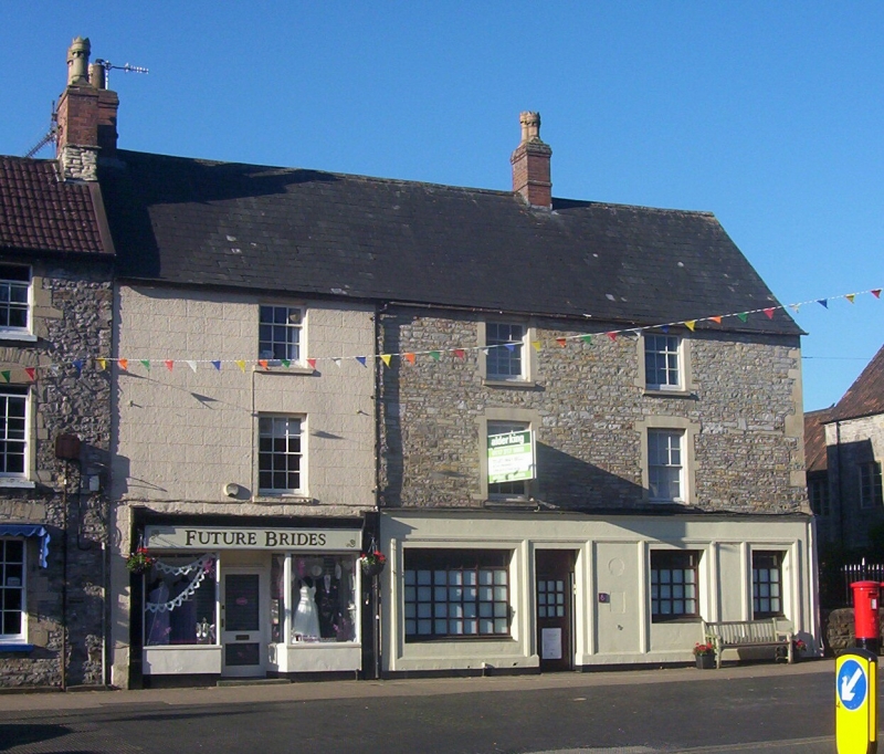
ST 7282 SE SODBURY HIGH STREET
5/78 (south side)
Nos 40 and 42
GV
II
Late C18. Render lined as ashlar. Slate roof. Brick stacks. Three storeys. Two
glazing bar sash windows to No 40, one to No 42. Modern ground floor front to No 40,
late C19 shopfront to No 42.
Listing NGR: ST7275882188
External links are from the relevant listing authority and, where applicable, Wikidata. Wikidata IDs may be related buildings as well as this specific building. If you want to add or update a link, you will need to do so by editing the Wikidata entry.


Other nearby listed buildings
