Latitude: 53.143 / 53°8'34"N
Longitude: -2.3613 / 2°21'40"W
OS Eastings: 375927
OS Northings: 360711
OS Grid: SJ759607
Mapcode National: GBR 010.XH7
Mapcode Global: WH9B0.P8RB
Plus Code: 9C5V4JVQ+6F
Entry Name: 53 and 55, High Street
Listing Date: 27 April 1978
Grade: II
Source: Historic England
Source ID: 1130356
English Heritage Legacy ID: 56216
ID on this website: 101130356
Location: Sandbach, Cheshire East, Cheshire, CW11
County: Cheshire East
Civil Parish: Sandbach
Built-Up Area: Sandbach
Traditional County: Cheshire
Lieutenancy Area (Ceremonial County): Cheshire
Church of England Parish: Sandbach
Church of England Diocese: Chester
Tagged with: Building
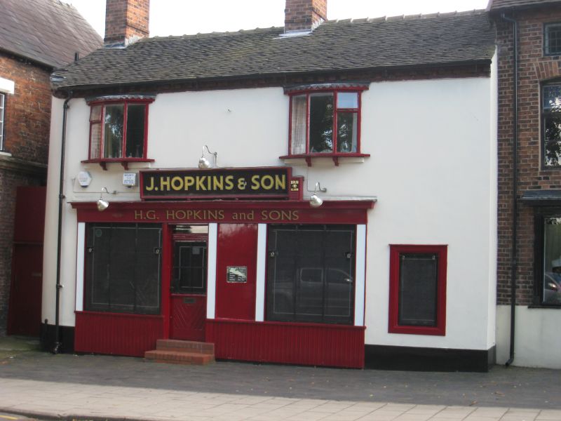
HIGH STREET
1.
5144
(South Side)
Nos 53 and 55
SJ 7560 1/69
II GV
2.
Early C19. Stucco; 2 storeys; 2 casement windows; simple early C19 shop fronts
with moulded cornices and modern glazing; cogged eaves; tiles. Included for group
valued
Listing NGR: SJ7592760711
External links are from the relevant listing authority and, where applicable, Wikidata. Wikidata IDs may be related buildings as well as this specific building. If you want to add or update a link, you will need to do so by editing the Wikidata entry.


Other nearby listed buildings