Approximate Location Map
Large Map »
Latitude: 53.1431 / 53°8'35"N
Longitude: -2.3616 / 2°21'41"W
OS Eastings: 375907
OS Northings: 360723
OS Grid: SJ759607
Mapcode National: GBR 010.XDL
Mapcode Global: WH9B0.P8M8
Plus Code: 9C5V4JVQ+68
Entry Name: 47, High Street
Listing Date: 27 April 1978
Grade: II
Source: Historic England
Source ID: 1330398
English Heritage Legacy ID: 56214
ID on this website: 101330398
Location: Sandbach, Cheshire East, Cheshire, CW11
County: Cheshire East
Civil Parish: Sandbach
Built-Up Area: Sandbach
Traditional County: Cheshire
Lieutenancy Area (Ceremonial County): Cheshire
Church of England Parish: Sandbach
Church of England Diocese: Chester
Tagged with: Building
HIGH STREET
1.
5144
(South Side)
No 47
SJ 7560 1/68
II GV
2.
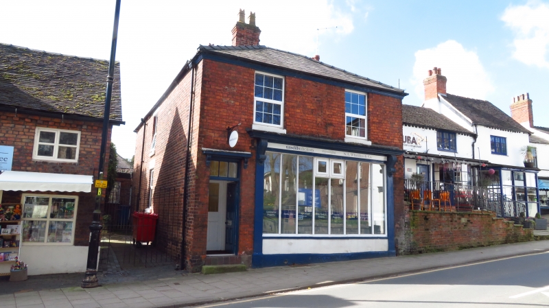
Early C19. Red brick; 2 storeys; 2 sash windows: doorway on left-hand side with
cornice hood on scrolls, and 6-panelled door; moulded stucco eaves; hipped slate
roof. Later C19 shop front with modern glazing. Included for group value.
Listing NGR: SJ7590760723
External links are from the relevant listing authority and, where applicable, Wikidata. Wikidata IDs may be related buildings as well as this specific building. If you want to add or update a link, you will need to do so by editing the Wikidata entry.


Other nearby listed buildings
