Approximate Location Map
Large Map »
Latitude: 53.1431 / 53°8'34"N
Longitude: -2.3615 / 2°21'41"W
OS Eastings: 375916
OS Northings: 360717
OS Grid: SJ759607
Mapcode National: GBR 010.XDM
Mapcode Global: WH9B0.P8P9
Plus Code: 9C5V4JVQ+6C
Entry Name: 49 and 51, High Street
Listing Date: 6 March 1978
Grade: II
Source: Historic England
Source ID: 1159844
English Heritage Legacy ID: 56215
ID on this website: 101159844
Location: Sandbach, Cheshire East, Cheshire, CW11
County: Cheshire East
Civil Parish: Sandbach
Built-Up Area: Sandbach
Traditional County: Cheshire
Lieutenancy Area (Ceremonial County): Cheshire
Church of England Parish: Sandbach
Church of England Diocese: Chester
Tagged with: Building
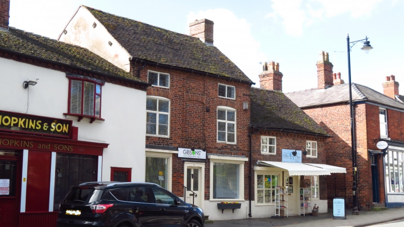
HIGH STREET
1.
5144
(South Side)
Nos 49 and 51
SJ 7560 1/12 6.3.78.
II GV
2.
Late C17 or early C18 adjoining small brick houses. Various casement windows.
Early C19 shop fronts with modern glazing; part glazed doors in plain doorways.
Toothed and plain eaves, gabled ends and old tiles. Both are 2 storeys. No 51
also has a shallow attic and some original leaded lights.
Listing NGR: SJ7591660717
External links are from the relevant listing authority and, where applicable, Wikidata. Wikidata IDs may be related buildings as well as this specific building. If you want to add or update a link, you will need to do so by editing the Wikidata entry.


Other nearby listed buildings
