Latitude: 51.1762 / 51°10'34"N
Longitude: -1.8031 / 1°48'11"W
OS Eastings: 413862
OS Northings: 141901
OS Grid: SU138419
Mapcode National: GBR 502.0ZP
Mapcode Global: VHB5B.PPNP
Plus Code: 9C3W55GW+FQ
Entry Name: Milestone Near Junction with A303(T)
Listing Date: 10 October 1988
Grade: II
Source: Historic England
Source ID: 1131071
English Heritage Legacy ID: 321388
ID on this website: 101131071
Location: West Amesbury, Wiltshire, SP4
County: Wiltshire
Civil Parish: Amesbury
Traditional County: Wiltshire
Lieutenancy Area (Ceremonial County): Wiltshire
Church of England Parish: Amesbury St Mary and St Melor
Church of England Diocese: Salisbury
Tagged with: Milestone
AMESBURY STONEHENGE ROAD
SU 14 SW
(east side)
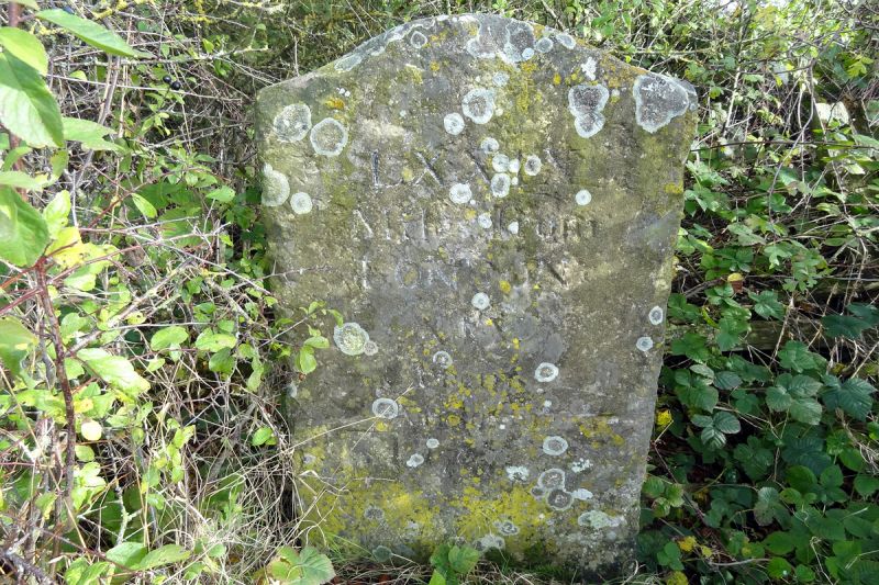
5/76 Milestone near junction with A303(T)
II
Milestone. Mid C18. Limestone. Large slab with double curved
top. Incised inscription reading LXXIX / Miles from / LONDON / XIX
/ from / Andover / 1764. Bench mark on left side.
Listing NGR: SU1386641894
External links are from the relevant listing authority and, where applicable, Wikidata. Wikidata IDs may be related buildings as well as this specific building. If you want to add or update a link, you will need to do so by editing the Wikidata entry.


Other nearby listed buildings