Latitude: 51.1723 / 51°10'20"N
Longitude: -1.7985 / 1°47'54"W
OS Eastings: 414182
OS Northings: 141473
OS Grid: SU141414
Mapcode National: GBR 502.G3K
Mapcode Global: VHB5B.SS2N
Plus Code: 9C3W56C2+WH
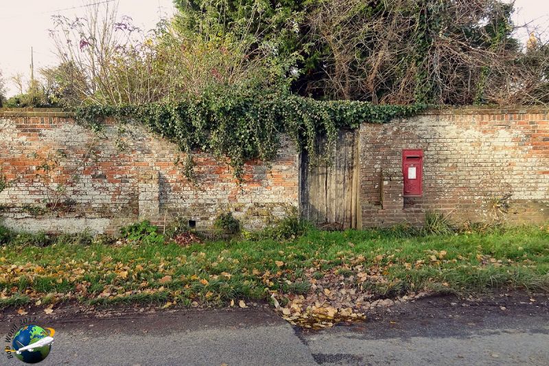
Entry Name: Wall Between Row of Cottages and West Amesbury House
Listing Date: 10 October 1988
Grade: II
Source: Historic England
Source ID: 1182703
English Heritage Legacy ID: 321391
ID on this website: 101182703
Location: West Amesbury, Wiltshire, SP4
County: Wiltshire
Civil Parish: Amesbury
Traditional County: Wiltshire
Lieutenancy Area (Ceremonial County): Wiltshire
Church of England Parish: Amesbury St Mary and St Melor
Church of England Diocese: Salisbury
Tagged with: Wall
AMESBURY WEST AMESBURY SU 1541 (west side)
11/79 Wall between row of cottages and West Amesbury House
GV II Garden wall linking row of cottages including Merion Cottage (q.v.) with West Amesbury House (q.v.). Probably C18 or early C19. Brick in garden wall bond, approximately 2m high with one offset above soldier course and horizontal brick coping. Offsetting plinth with short pilaster buttresses. Boarded gate and flush iron wall postbox dated GVIR by W.T. Allen. Included primarily for group value.
Listing NGR: SU1418241473
External links are from the relevant listing authority and, where applicable, Wikidata. Wikidata IDs may be related buildings as well as this specific building. If you want to add or update a link, you will need to do so by editing the Wikidata entry.


Other nearby listed buildings