Latitude: 51.1725 / 51°10'20"N
Longitude: -1.7971 / 1°47'49"W
OS Eastings: 414280
OS Northings: 141491
OS Grid: SU142414
Mapcode National: GBR 502.GGG
Mapcode Global: VHB5B.SSTK
Plus Code: 9C3W56C3+X5
Entry Name: Garden Walls to North of West Amesbury House
Listing Date: 10 January 1953
Grade: II
Source: Historic England
Source ID: 1318516
English Heritage Legacy ID: 321395
ID on this website: 101318516
Location: West Amesbury, Wiltshire, SP4
County: Wiltshire
Civil Parish: Amesbury
Traditional County: Wiltshire
Lieutenancy Area (Ceremonial County): Wiltshire
Church of England Parish: Amesbury St Mary and St Melor
Church of England Diocese: Salisbury
Tagged with: Wall
AMESBURY WEST AMESBURY SU 1541 11/83 Garden walls to north of West Amesbury House 10.1.53
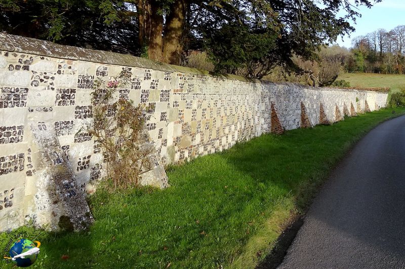
GV II Walls forming north, east and south boundaries to east garden of house. C17 to C19. Wall to road approximately 66m long, 4m high, of flint with stone coping and raking buttresses. Wall returns on east side, approximately 43m long, of brick and returns by approximately 64m on north side, also of brick, and including thatched brick gazebo.
Listing NGR: SU1428041491
External links are from the relevant listing authority and, where applicable, Wikidata. Wikidata IDs may be related buildings as well as this specific building. If you want to add or update a link, you will need to do so by editing the Wikidata entry.


Other nearby listed buildings