Latitude: 54.0649 / 54°3'53"N
Longitude: -1.9939 / 1°59'37"W
OS Eastings: 400499
OS Northings: 463215
OS Grid: SE004632
Mapcode National: GBR GPJF.4L
Mapcode Global: WHB6W.B3S3
Plus Code: 9C6W3274+XF
Entry Name: Sundial and Grave Slab Approximately 8 Metres South of Nave of Church of St Michael
Listing Date: 23 June 1989
Grade: II
Source: Historic England
Source ID: 1132157
English Heritage Legacy ID: 324804
ID on this website: 101132157
Location: St Michael and All Angels Church, Thorpe Fell View, North Yorkshire, BD23
County: North Yorkshire
District: Craven
Civil Parish: Linton
Built-Up Area: Grassington
Traditional County: Yorkshire
Lieutenancy Area (Ceremonial County): North Yorkshire
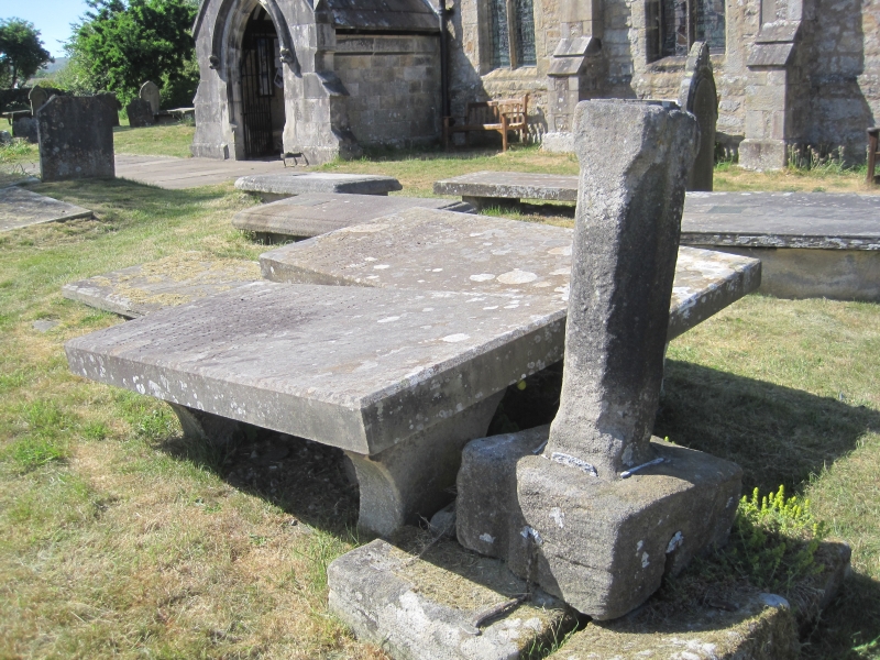
LINTON CHURCH ROAD SE 0063-0163 (east end) 10/50 Sundial and grave slab approximately 8 metres south of nave of Church of St. Michael GV II Sundial and grave slab. Dated 1637. Gritstone and limestone. The sundial shaft is approximately 80 centimetres high and is set into a square plinth raised up on 3 blocks, all clamped with iron staples set in lead. The east side of the plinth is resting on a stone block which in turn covers the west end of a narrow grave slab with brass plaque inscribed. "HEARE LYETH THE BODY / OF ROBERT WEST ANNO / DOMINI 1637 MAY 16 " The sundial shaft is chamfered with straight run-out stops, gnomon missing, and has the weathered initials "R W " on the face. Similar to the sundial at Kildwick (q.v.). Included for group value.
Listing NGR: SE0049963215


Other nearby listed buildings