Approximate Location Map
Large Map »
Latitude: 54.0658 / 54°3'57"N
Longitude: -2.0008 / 2°0'2"W
OS Eastings: 400046
OS Northings: 463322
OS Grid: SE000633
Mapcode National: GBR GPGF.M8
Mapcode Global: WHB6W.72HD
Plus Code: 9C6V3X8X+8M
Entry Name: Lile Emilys Bridge
Listing Date: 10 September 1954
Grade: II
Source: Historic England
Source ID: 1167202
English Heritage Legacy ID: 324805
Also known as: Miss Emily's Bridge
Little Emily's Bridge
ID on this website: 101167202
Location: Linton, North Yorkshire, BD23
County: North Yorkshire
District: Craven
Civil Parish: Linton
Built-Up Area: Threshfield
Traditional County: Yorkshire
Lieutenancy Area (Ceremonial County): North Yorkshire
Tagged with: Bridge
LINTON CHURCH ROAD
SE 0063-0163
(north side, off)
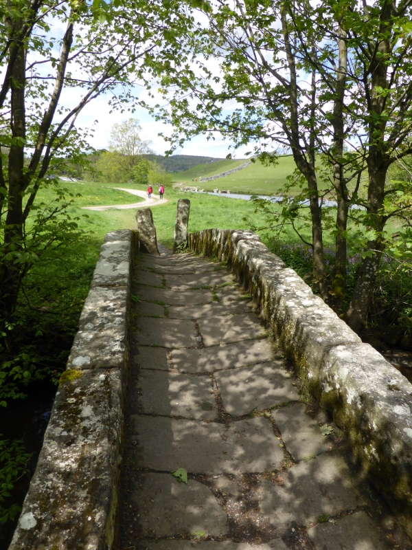
10/51 Li'le Emily's Bridge
10.9.54
II
Bridge over Captain Beck. Probably late C17- early C18. Rubble, single
arch, slightly hump-backed. A narrow footbridge paved with stone slabs,
the arch having rubble voussoirs and large blocks to the ridged parapet.
The north end is closed by 2 closely-set stones forming a stile. The
bridge carried the footpath from the bridge at Grassington (also known as
Linton Bridge. q.v.) to the Linton Mill and to the church (q.v.).
Listing NGR: SE0004663322
External links are from the relevant listing authority and, where applicable, Wikidata. Wikidata IDs may be related buildings as well as this specific building. If you want to add or update a link, you will need to do so by editing the Wikidata entry.


Other nearby listed buildings
