Latitude: 52.2442 / 52°14'38"N
Longitude: 0.7127 / 0°42'45"E
OS Eastings: 585301
OS Northings: 264130
OS Grid: TL853641
Mapcode National: GBR QF0.71K
Mapcode Global: VHKD4.9VNH
Plus Code: 9F426PV7+M3
Entry Name: 86, Whiting Street
Listing Date: 12 July 1972
Grade: II
Source: Historic England
Source ID: 1132595
English Heritage Legacy ID: 467852
ID on this website: 101132595
Location: Bury St Edmunds, West Suffolk, IP33
County: Suffolk
District: West Suffolk
Civil Parish: Bury St Edmunds
Built-Up Area: Bury St Edmunds
Traditional County: Suffolk
Lieutenancy Area (Ceremonial County): Suffolk
Church of England Parish: Bury St Edmunds St Mary
Church of England Diocese: St.Edmundsbury and Ipswich
Tagged with: Building
BURY ST EDMUNDS
TL8564SW WHITING STREET 639-1/14/731 (West side) 12/07/72 No.86
GV II
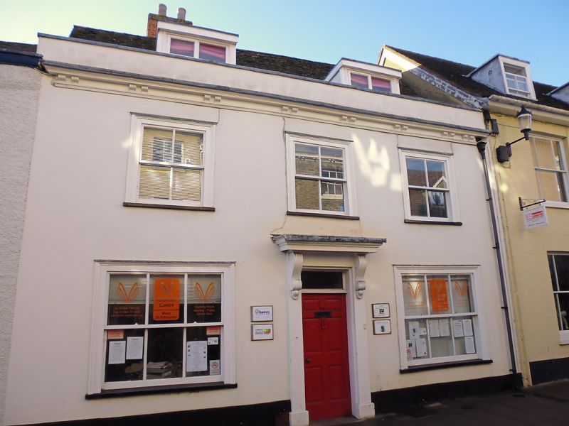
House, now consulting rooms and offices. C17; late C18 front with a parapet and cornice with paired mutules. Plaintiled roof. A large internal chimney-stack with a plain rectangular red brick shaft. EXTERIOR: 2 storeys, cellar and attics; 3 window range: sashes with a single vertical glazing bar in flush cased frames. 2 flat-headed dormers. A 6-panel door with a plain rectangular fanlight has a wood doorcase with a cornice supported on enriched console brackets. INTERIOR: cellar below the whole of the front range, mainly in rubble flint and old render with a vaulted brick arch at one end and stone blocks in the north end wall. The timber frame is in 4 bays with the main components exposed on the 1st storey: main posts with long jowls; a cambered tie-beam at the south end, possibly related to the adjoining house; the remaining tie-beams chamfered with curved stops. A 3-storey C19 rear range in painted brick has a pitched slate roof. 2 window range: 12-pane sashes to 1st storey with segmental-arched heads and deep reveals; C19 casement windows in flush frames to 2nd storey. An end chimney-stack on the north with a plain rectangular red brick shaft. The front and rear ranges are linked by an early C19 stair with stick balusters, wreathed handrails and column newels which divides into 2 flights at the half landing.
Listing NGR: TL8530164130
External links are from the relevant listing authority and, where applicable, Wikidata. Wikidata IDs may be related buildings as well as this specific building. If you want to add or update a link, you will need to do so by editing the Wikidata entry.


Other nearby listed buildings