Latitude: 53.4153 / 53°24'55"N
Longitude: -1.6174 / 1°37'2"W
OS Eastings: 425526
OS Northings: 391016
OS Grid: SK255910
Mapcode National: GBR KX4Y.MF
Mapcode Global: WHCC9.4F22
Plus Code: 9C5WC98M+42
Entry Name: Monument approximately 110 metres west of junction with Ughill Road
Listing Date: 8 August 1985
Grade: II
Source: Historic England
Source ID: 1132818
English Heritage Legacy ID: 335424
Also known as: Edgefield Obelisk
ID on this website: 101132818
Location: Ughill, Sheffield, South Yorkshire, S6
County: Sheffield
Civil Parish: Bradfield
Traditional County: Yorkshire
Lieutenancy Area (Ceremonial County): South Yorkshire
Church of England Parish: Bradfield St Nicholas
Church of England Diocese: Sheffield
Tagged with: Monument
This list entry was subject to a Minor Amendment on 19 September 2024 to update the name, address and reformat the text to current standards
SK29SE
9/101
BRADFIELD
HOAR STONES ROAD
Monument approximately 110 metres west of junction with Ughill Road.
(Formerly listed as STONES ROAD, (north side))
II
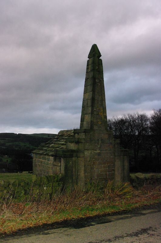
Monument. Mid C19. Gritstone ashlar, horizontally tooled wallstone, stone slate roof. Obelisk set on tiered rectangular plinth with adjoining single-storey wing entered from gable at rear. Twin tapered corner pilasters to either side of wallstone panel and linked at the top by projecting band. Two tiered ashlar plinths both with projecting bands. The lower plinth with defaced inscription which appears to have read: 'EDGEFIELD A.D. 18--'. Obelisk above with sunken cruciform motif in wallstone panel and pyramidal stone cap.
To rear: small cell built in coursed wallstone on plinth, boarded door.
Interior: steps down to spring-water source.
Listing NGR: SK2552691016
External links are from the relevant listing authority and, where applicable, Wikidata. Wikidata IDs may be related buildings as well as this specific building. If you want to add or update a link, you will need to do so by editing the Wikidata entry.


Other nearby listed buildings