Approximate Location Map
Large Map »
Latitude: 53.6624 / 53°39'44"N
Longitude: -1.8241 / 1°49'26"W
OS Eastings: 411718
OS Northings: 418445
OS Grid: SE117184
Mapcode National: GBR HVP2.WW
Mapcode Global: WHCB0.Y6JP
Plus Code: 9C5WM56G+W8
Entry Name: Almshouses Archway Between Numbers 2 and 4
Listing Date: 29 September 1978
Grade: II
Source: Historic England
Source ID: 1134288
English Heritage Legacy ID: 339802
ID on this website: 101134288
Location: Birchencliffe, Kirklees, West Yorkshire, HD3
County: Kirklees
Electoral Ward/Division: Lindley
Parish: Non Civil Parish
Built-Up Area: Huddersfield
Traditional County: Yorkshire
Lieutenancy Area (Ceremonial County): West Yorkshire
Church of England Parish: Lindley St Stephen
Church of England Diocese: Leeds
Tagged with: Almshouse
EAST STREET
1.
5113
(South Side)
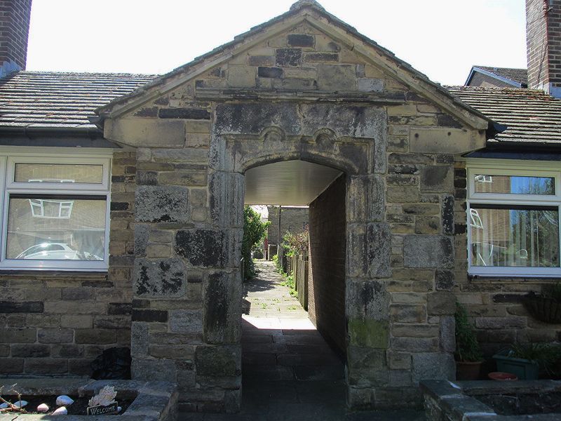
Almshouses: archway
between Nos 2 and 4
SE 1118 20/475
II
2.
C17 or early C18. Ashlar. 4-centred arch in oblong frame. Moulded jambs
with 2 semi-circular recessions along top.
Listing NGR: SE1171818445
External links are from the relevant listing authority and, where applicable, Wikidata. Wikidata IDs may be related buildings as well as this specific building. If you want to add or update a link, you will need to do so by editing the Wikidata entry.


Other nearby listed buildings
