Approximate Location Map
Large Map »
Latitude: 53.6629 / 53°39'46"N
Longitude: -1.8231 / 1°49'23"W
OS Eastings: 411784
OS Northings: 418504
OS Grid: SE117185
Mapcode National: GBR HVQ2.3P
Mapcode Global: WHCB0.Z609
Plus Code: 9C5WM57G+5P
Entry Name: Former Coachhouse
Listing Date: 29 September 1978
Grade: II
Source: Historic England
Source ID: 1290075
English Heritage Legacy ID: 339796
ID on this website: 101290075
Location: Birchencliffe, Kirklees, West Yorkshire, HD3
County: Kirklees
Electoral Ward/Division: Lindley
Parish: Non Civil Parish
Built-Up Area: Huddersfield
Traditional County: Yorkshire
Lieutenancy Area (Ceremonial County): West Yorkshire
Church of England Parish: Birchencliffe St Philip the Apostle
Church of England Diocese: Leeds
Tagged with: Architectural structure
1.
5113
SE 1118 20/466
EAST STREET
(North Side)
Lindley
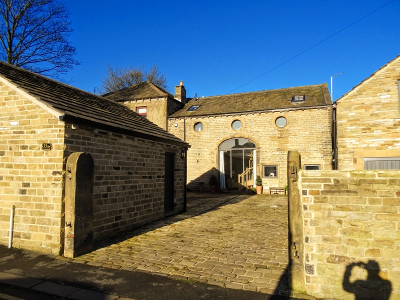
Former coachhouse adjacent to No 35
II
2.
Mid C19. Hammer-dressed stone. Pitched stone slate roof. Stone brackets
to gutter. Depressed arched carriage entrance. 3 oculi with plain raised
frames.
Listing NGR: SE 11784 18504
External links are from the relevant listing authority and, where applicable, Wikidata. Wikidata IDs may be related buildings as well as this specific building. If you want to add or update a link, you will need to do so by editing the Wikidata entry.


Other nearby listed buildings
