Approximate Location Map
Large Map »
Latitude: 53.6827 / 53°40'57"N
Longitude: -1.7472 / 1°44'49"W
OS Eastings: 416797
OS Northings: 420723
OS Grid: SE167207
Mapcode National: GBR JT7V.JL
Mapcode Global: WHC9W.4P9M
Plus Code: 9C5WM7M3+34
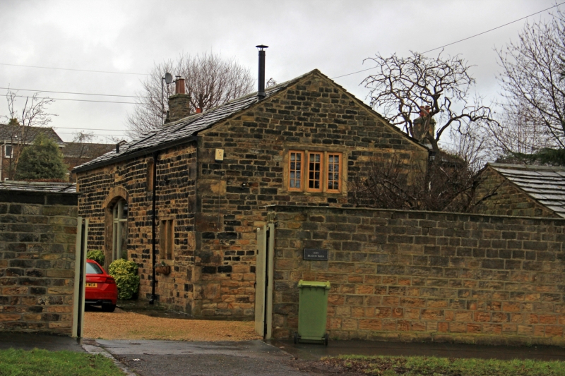
Entry Name: Barn to No 164 (Bradley Grange)
Listing Date: 29 September 1978
Grade: II
Source: Historic England
Source ID: 1134366
English Heritage Legacy ID: 339584
ID on this website: 101134366
Location: Bradley, Kirklees, West Yorkshire, HD2
County: Kirklees
Electoral Ward/Division: Ashbrow
Parish: Non Civil Parish
Built-Up Area: Huddersfield
Traditional County: Yorkshire
Lieutenancy Area (Ceremonial County): West Yorkshire
Church of England Parish: Bradley St Thomas
Church of England Diocese: Leeds
Tagged with: Barn
BRADLEY ROAD
1.
5113
(North Side)
Barn to No 164
(Bradley Grange)
SE 1620 12/235
II
2.
C18. Hammer-dressed stone. Pitched stone slate roof. Various stone mullioned
windows with glazing bars.
Listing NGR: SE1679720723
External links are from the relevant listing authority and, where applicable, Wikidata. Wikidata IDs may be related buildings as well as this specific building. If you want to add or update a link, you will need to do so by editing the Wikidata entry.


Other nearby listed buildings
