Approximate Location Map
Large Map »
Latitude: 53.7058 / 53°42'21"N
Longitude: -1.7302 / 1°43'48"W
OS Eastings: 417909
OS Northings: 423301
OS Grid: SE179233
Mapcode National: GBR JTCL.69
Mapcode Global: WHC9W.D3BW
Plus Code: 9C5WP749+8W
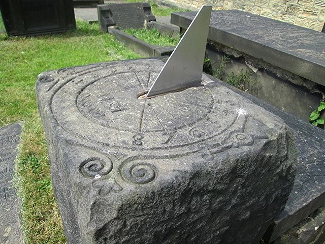
Entry Name: Sundial to South of Chancel of St Peter's Church
Listing Date: 13 January 1984
Grade: II
Source: Historic England
Source ID: 1134589
English Heritage Legacy ID: 340999
ID on this website: 101134589
Location: St Peter's Church, Hartshead, Kirklees, West Yorkshire, WF15
County: Kirklees
Electoral Ward/Division: Liversedge and Gomersal
Parish: Non Civil Parish
Traditional County: Yorkshire
Lieutenancy Area (Ceremonial County): West Yorkshire
Church of England Parish: Hartsheadst Peter
Church of England Diocese: Leeds
Tagged with: Sundial
SE 12 SE SPENBOROUGH MB CHURCH LANE
HARTSHEAD
3/93
Sundial to south of
chancel of St Peter's Church
G.V. II
Sundial. Dated 1611. Rectangular stone post with well carved
decorative top. Metal gnomon.
Listing NGR: SE1790923301
External links are from the relevant listing authority and, where applicable, Wikidata. Wikidata IDs may be related buildings as well as this specific building. If you want to add or update a link, you will need to do so by editing the Wikidata entry.


Other nearby listed buildings
