Approximate Location Map
Large Map »
Latitude: 53.7023 / 53°42'8"N
Longitude: -1.737 / 1°44'13"W
OS Eastings: 417462
OS Northings: 422902
OS Grid: SE174229
Mapcode National: GBR JT9M.RK
Mapcode Global: WHC9W.963M
Plus Code: 9C5WP727+W6
Entry Name: Boundary Stone 450 Yards West of Junction with Church Lane
Listing Date: 13 January 1984
Grade: II
Source: Historic England
Source ID: 1184286
English Heritage Legacy ID: 341013
ID on this website: 101184286
Location: Kirklees, West Yorkshire, WF15
County: Kirklees
Electoral Ward/Division: Liversedge and Gomersal
Parish: Non Civil Parish
Traditional County: Yorkshire
Lieutenancy Area (Ceremonial County): West Yorkshire
Church of England Parish: Hartsheadst Peter
Church of England Diocese: Leeds
Tagged with: Boundary marker
SE 1747 2291 SPENBOROUGH MB FREAKFIELD LANE
HARTSHEAD
3/106
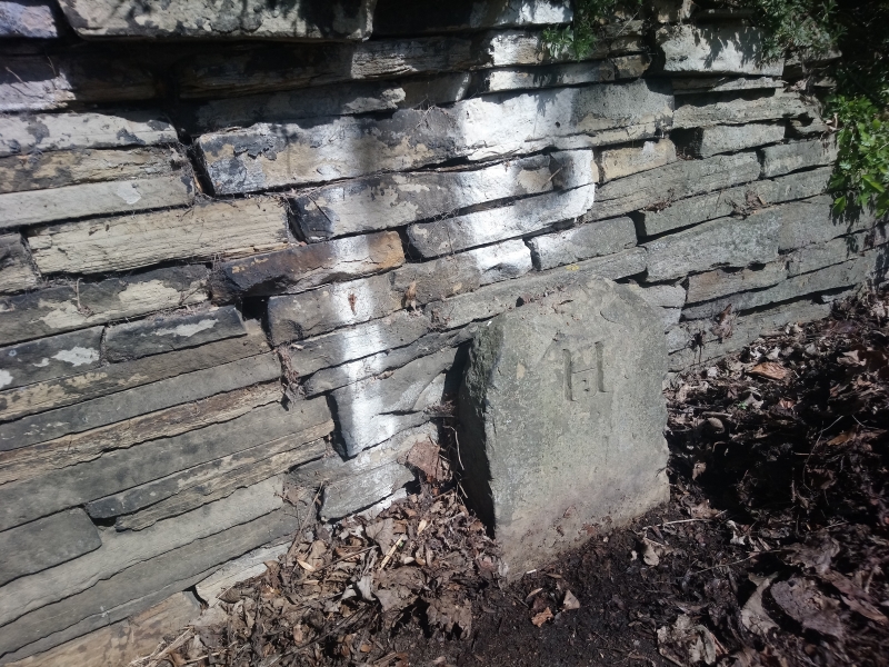
Boundary Stone 450 yards
west of junction with
Church Lane
II
Boundary stone. Early C.19. Stone post with rounded top and inscribed,
well cut, letter H. for Hartshead. Partly broken at top.
Listing NGR: SE1746222902
External links are from the relevant listing authority and, where applicable, Wikidata. Wikidata IDs may be related buildings as well as this specific building. If you want to add or update a link, you will need to do so by editing the Wikidata entry.


Other nearby listed buildings
