Latitude: 53.6367 / 53°38'12"N
Longitude: -1.7657 / 1°45'56"W
OS Eastings: 415591
OS Northings: 415603
OS Grid: SE155156
Mapcode National: GBR JV3D.J2
Mapcode Global: WHCB1.VVDD
Plus Code: 9C5WJ6PM+MP
Entry Name: 56, Lowerhouses Lane
Listing Date: 29 September 1978
Grade: II
Source: Historic England
Source ID: 1134975
English Heritage Legacy ID: 340174
ID on this website: 101134975
Location: Benomley, Kirklees, West Yorkshire, HD5
County: Kirklees
Electoral Ward/Division: Newsome
Parish: Non Civil Parish
Built-Up Area: Huddersfield
Traditional County: Yorkshire
Lieutenancy Area (Ceremonial County): West Yorkshire
Church of England Parish: Almondbury with Farnley Tyas Team Parish
Church of England Diocese: Leeds
Tagged with: Building
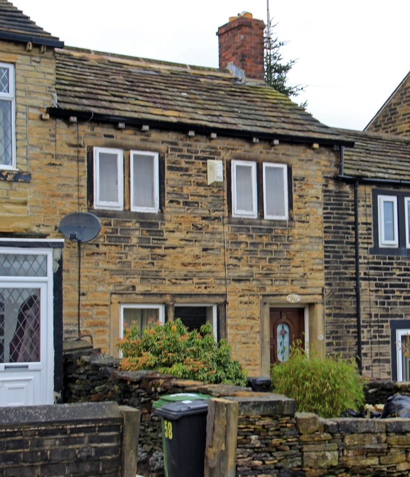
LOWERHOUSES LANE
1.
5113
(West Side)
Lower House
No 56
SE 1515 39/853
II
2.
Early C19. Hammer-dressed stone. Pitched stone slate roof. 2 storeys. Two
2-light stone mullioned windows on 1st floor and one on ground floor.
Listing NGR: SE1559115603
External links are from the relevant listing authority and, where applicable, Wikidata. Wikidata IDs may be related buildings as well as this specific building. If you want to add or update a link, you will need to do so by editing the Wikidata entry.


Other nearby listed buildings