Approximate Location Map
Large Map »
Latitude: 53.6343 / 53°38'3"N
Longitude: -1.7655 / 1°45'55"W
OS Eastings: 415602
OS Northings: 415335
OS Grid: SE156153
Mapcode National: GBR JV3D.KY
Mapcode Global: WHCB1.VXG7
Plus Code: 9C5WJ6MM+PQ
Entry Name: 160, Lowerhouses Lane
Listing Date: 29 September 1978
Grade: II
Source: Historic England
Source ID: 1215414
English Heritage Legacy ID: 340176
ID on this website: 101215414
Location: Longley, Kirklees, West Yorkshire, HD5
County: Kirklees
Electoral Ward/Division: Newsome
Parish: Non Civil Parish
Built-Up Area: Huddersfield
Traditional County: Yorkshire
Lieutenancy Area (Ceremonial County): West Yorkshire
Church of England Parish: Almondbury with Farnley Tyas Team Parish
Church of England Diocese: Leeds
Tagged with: Building
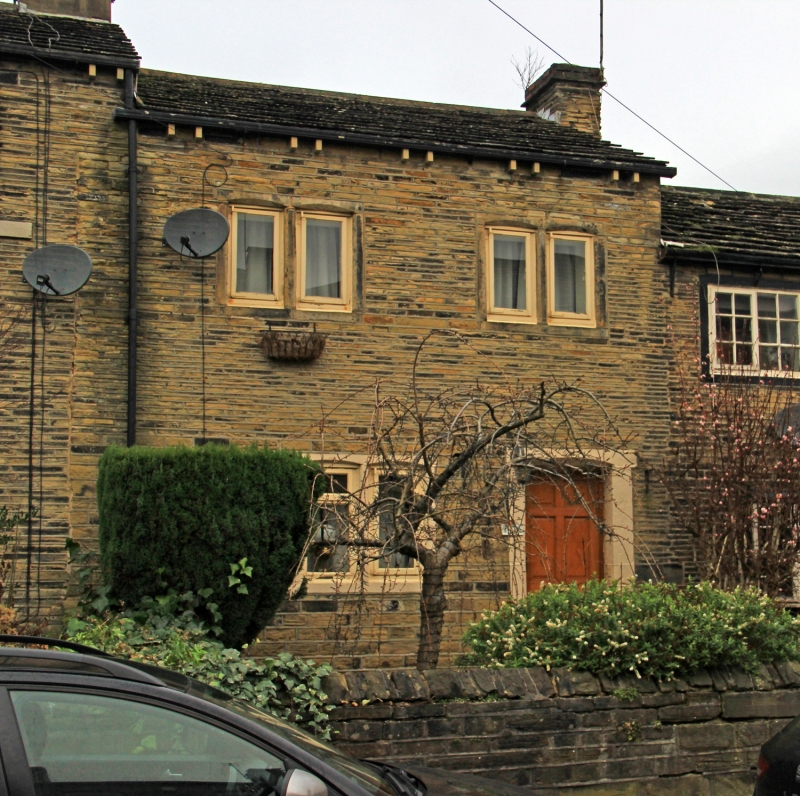
LOWERHOUSES LANE
1.
5113
(West Side)
Lower House
No 160
SE 1515 39/855
II
C19. Coursed rubble. Pitched stone slate roof. 2 storeys. Two 2-light stone
mullioned windows on 1st floor. One 3-light stone mullioned window on ground
floor. All with chamfered mullions and lintels.
Listing NGR: SE1560215335
External links are from the relevant listing authority and, where applicable, Wikidata. Wikidata IDs may be related buildings as well as this specific building. If you want to add or update a link, you will need to do so by editing the Wikidata entry.


Other nearby listed buildings
