Approximate Location Map
Large Map »
Latitude: 53.6359 / 53°38'9"N
Longitude: -1.7662 / 1°45'58"W
OS Eastings: 415559
OS Northings: 415507
OS Grid: SE155155
Mapcode National: GBR JV3D.FC
Mapcode Global: WHCB1.VW41
Plus Code: 9C5WJ6PM+8G
Entry Name: 96 and 98, Lowerhouses Lane
Listing Date: 29 September 1978
Grade: II
Source: Historic England
Source ID: 1313501
English Heritage Legacy ID: 340175
ID on this website: 101313501
Location: Longley, Kirklees, West Yorkshire, HD5
County: Kirklees
Electoral Ward/Division: Newsome
Parish: Non Civil Parish
Built-Up Area: Huddersfield
Traditional County: Yorkshire
Lieutenancy Area (Ceremonial County): West Yorkshire
Church of England Parish: Almondbury with Farnley Tyas Team Parish
Church of England Diocese: Leeds
Tagged with: Building
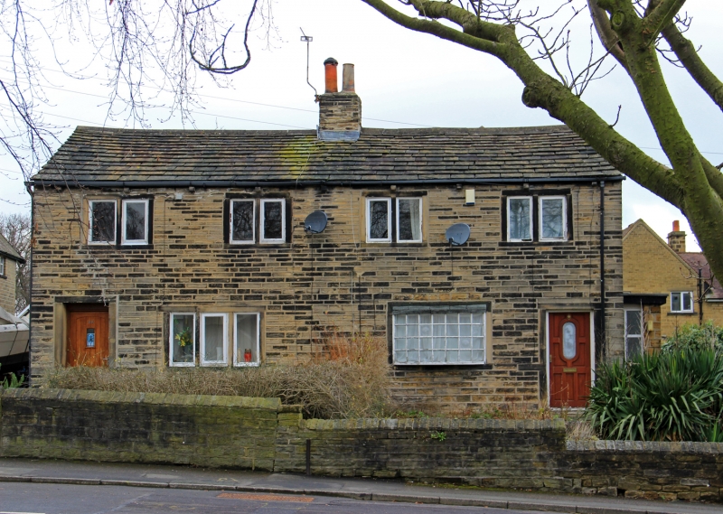
LOWERHOUSES LANE
1.
5113
(West Side)
Lower House
Nos 96 and 98
SE 1515 39/854
II
2.
C19. Hammer-dressed stone. Pitched stone slate roof. 2 storeys. Four 2-light
stone mullioned windows on 1st floor. One 3-light stone mullioned window on
ground floor, and one modern neo-Georgian bay.
Listing NGR: SE1555915507
External links are from the relevant listing authority and, where applicable, Wikidata. Wikidata IDs may be related buildings as well as this specific building. If you want to add or update a link, you will need to do so by editing the Wikidata entry.


Other nearby listed buildings
