Latitude: 53.605 / 53°36'17"N
Longitude: -1.7378 / 1°44'15"W
OS Eastings: 417449
OS Northings: 412079
OS Grid: SE174120
Mapcode National: GBR JV9R.KF
Mapcode Global: WHCB8.8NR6
Plus Code: 9C5WJ736+XV
Entry Name: Old Guide Post at Junction with Stores Hall Road
Listing Date: 16 May 1984
Grade: II
Source: Historic England
Source ID: 1135355
English Heritage Legacy ID: 341147
ID on this website: 101135355
Location: Moor Side, Kirklees, West Yorkshire, HD4
County: Kirklees
Civil Parish: Kirkburton
Traditional County: Yorkshire
Lieutenancy Area (Ceremonial County): West Yorkshire
Church of England Parish: Thurstonland St Thomas
Church of England Diocese: Leeds
Tagged with: Architectural structure Guidestone Guidestone
SE 11 SE FARNLEY ROAD SE 1745 1208 Farnley Tyas 5/31 Old guide post at junction with Storthes Hall Road
II
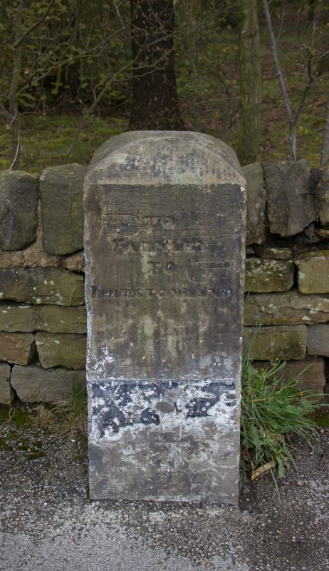
Guide post. Dated 1861. Square stone post with domed top, inscribed on two faces in capitals: TO TO KIRKBURTON FARNLEY JOHN TO BOTTOMLEY THURSTONLAND SURVEYOR 1861 In each case a stylised hand points the direction.
Listing NGR: SE1744912079
External links are from the relevant listing authority and, where applicable, Wikidata. Wikidata IDs may be related buildings as well as this specific building. If you want to add or update a link, you will need to do so by editing the Wikidata entry.


Other nearby listed buildings