Latitude: 53.8887 / 53°53'19"N
Longitude: -1.4339 / 1°26'1"W
OS Eastings: 437306
OS Northings: 443764
OS Grid: SE373437
Mapcode National: GBR LRFG.CR
Mapcode Global: WHDB5.YJC5
Plus Code: 9C5WVHQ8+FF
Entry Name: East Rigton Farmhouse
Listing Date: 22 July 1986
Grade: II
Source: Historic England
Source ID: 1135658
English Heritage Legacy ID: 342137
ID on this website: 101135658
Location: Bardsey, Leeds, West Yorkshire, LS17
County: Leeds
Civil Parish: Bardsey cum Rigton
Built-Up Area: Bardsey
Traditional County: Yorkshire
Lieutenancy Area (Ceremonial County): West Yorkshire
Church of England Parish: Bardsey All Hallows
Church of England Diocese: Leeds
Tagged with: Farmhouse
BARDSEY-CUM-RIGTON MILL LANE SE34SE LS17 (east side), SE3743 East Rigton 7/11 East Rigton Farmhouse
II
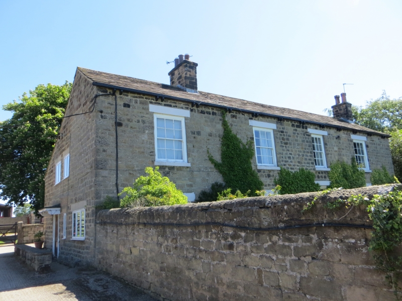
House. c1780, roof raised and refenestrated early C19. Hammer-dressed stone, stone slate roof. 3-cell through-passage plan. 2 storeys. Four 1st-floor windows, 4 bays. quoins. 3rd bay has doorway with 1¼ pilasters, 6-panel door and glazed overlight. Windows have monolithic lintels, projecting sills and 12-pane sashes in flush wood architraves. 1st bay ground-floor window has altered glazing. Paired shaped gutter brackets. Gable stack to right and one other ridge stack. Left-hand return has former gable-entry doorway, now partly blocked, to right of inserted doorway. 2 windows above to 1st floor. Earlier C18 roofline clearly discernible shows it had a single storey rear outshut originally.
In the garden is a stone dated 1781, thought to have come from the house originally indicating its date of erection.
Listing NGR: SE3730643764
External links are from the relevant listing authority and, where applicable, Wikidata. Wikidata IDs may be related buildings as well as this specific building. If you want to add or update a link, you will need to do so by editing the Wikidata entry.


Other nearby listed buildings