Latitude: 53.8857 / 53°53'8"N
Longitude: -1.4434 / 1°26'36"W
OS Eastings: 436684
OS Northings: 443418
OS Grid: SE366434
Mapcode National: GBR LRCH.9V
Mapcode Global: WHDB5.SLVJ
Plus Code: 9C5WVHP4+7M
Entry Name: Barn and Ancillary Outbuilding to North West of Bardsey Grange
Listing Date: 5 February 1973
Last Amended: 22 July 1986
Grade: II
Source: Historic England
Source ID: 1185442
English Heritage Legacy ID: 342134
ID on this website: 101185442
Location: Bardsey, Leeds, West Yorkshire, LS17
County: Leeds
Civil Parish: Bardsey cum Rigton
Built-Up Area: Bardsey
Traditional County: Yorkshire
Lieutenancy Area (Ceremonial County): West Yorkshire
Church of England Parish: Bardsey All Hallows
Church of England Diocese: Leeds
Tagged with: Barn
BARDSEY-CUM-RIGTON CORN MILL LANE SE34SE LS17 (north side) 7/8 5.2.73 Barn and ancillary outbuilding to north-west of Bardsey Grange (formerly listed on Mill Lane)
GV II
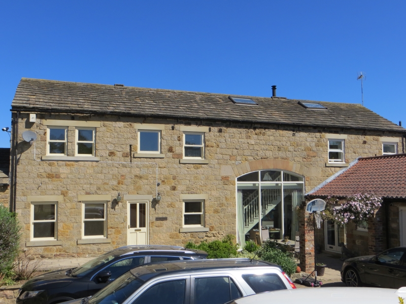
Barn and attached cart shed. Late C18. Hammer-dressed stone, stone slate roof to barn; brick with pantile roof partly replaced by asbestos to cart shed. Barn: 2 storeys. 8 bays. Tall segmental-arched cart-entry set in 6th bay, has finely-dressed voussoirs. To left, 3 rows of tall slit ventilators. To right, 2 ventilators above range of cart sheds at right angles with brick piers, the entrances mainly infilled with later brick. Rear of barn: tall segmental-arched cart-entry with composite jambs with 2 rows of ventilators to left and 3 rows to right. 1st floor has window either side of cart-entry with deep lintels and keystones. Left-hand return has mistal doorway and window to apex, both with keyed lintels.
Interior: fine fish-bone king-post roof.
Listing NGR: SE3668443418
External links are from the relevant listing authority and, where applicable, Wikidata. Wikidata IDs may be related buildings as well as this specific building. If you want to add or update a link, you will need to do so by editing the Wikidata entry.


Other nearby listed buildings