Approximate Location Map
Large Map »
Latitude: 51.3996 / 51°23'58"N
Longitude: -1.4486 / 1°26'54"W
OS Eastings: 438458
OS Northings: 166873
OS Grid: SU384668
Mapcode National: GBR 70H.6LN
Mapcode Global: VHC20.V22X
Plus Code: 9C3W9HX2+RH
Entry Name: Kennett House
Listing Date: 21 June 1984
Grade: II
Source: Historic England
Source ID: 1135754
English Heritage Legacy ID: 39747
ID on this website: 101135754
Location: Kintbury, West Berkshire, RG17
County: West Berkshire
Civil Parish: Kintbury
Built-Up Area: Kintbury
Traditional County: Berkshire
Lieutenancy Area (Ceremonial County): Berkshire
Church of England Parish: Kintbury
Church of England Diocese: Oxford
Tagged with: House
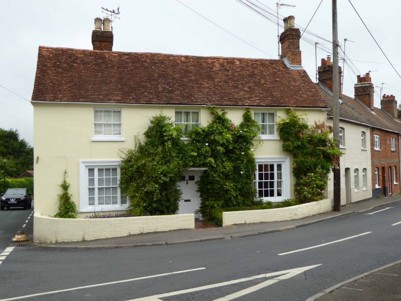
SU 36 NE KINTBURY STATION ROAD (south side)
12/32 No. 27 (Kennett House)
II
House. Late C18. Render, painted and lined out, tiled roof. Rectangular
plan. 2 storeys, flanking chimney to south. 3 glazing bar sashes on first
floor, central 6 panel door with top panels glazed in simple architrave
surround with flat hood on cut brackets, flanked by tripartite glazing bar
sashes in moulded architraves.
Listing NGR: SU3845866873
External links are from the relevant listing authority and, where applicable, Wikidata. Wikidata IDs may be related buildings as well as this specific building. If you want to add or update a link, you will need to do so by editing the Wikidata entry.


Other nearby listed buildings
