Latitude: 51.4937 / 51°29'37"N
Longitude: -2.5484 / 2°32'54"W
OS Eastings: 362021
OS Northings: 177332
OS Grid: ST620773
Mapcode National: GBR CL3.HD
Mapcode Global: VH88G.SQ3B
Plus Code: 9C3VFFV2+FJ
Entry Name: Tunnel Waterway in Barn Wood
Listing Date: 1 March 1991
Grade: II
Source: Historic England
Source ID: 1136275
English Heritage Legacy ID: 35055
ID on this website: 101136275
Location: Stoke Park, Broomhill, South Gloucestershire, BS16
County: South Gloucestershire
Civil Parish: Stoke Gifford
Built-Up Area: Filton
Traditional County: Gloucestershire
Lieutenancy Area (Ceremonial County): Gloucestershire
Church of England Parish: Stoke Gifford
Church of England Diocese: Bristol
Tagged with: Architectural structure
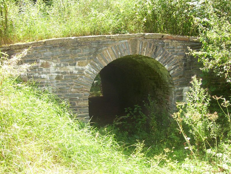
621774 STOKE PARK 4/25 Tunnel Waterway in Barn Wood GV II Tunnel, probably a waterway. c1750, by Thomas Wright. Limestone. A vaulted tunnel with a barrier or weir at its north end, probably part of decorative waterway, connected with a collection pool (q.v) in the landscaped grounds of Stoke Park Dower House (q.v) and part of an organised perambulation in the Park. Tunnel is clO metres long, paved floor, 1.5m wider and 2 m high, in regular limestone courses and shaped voussoir vault; an opening or skylight occurs at about mid-length. At the higher, east end is an upright flat slab forming a weir overflow, and the floor is paved in Pennant slabs. At both ends the stonework is rough, and may originally have been dressed fair. (Stewart Harding and David Lambert: 'Saving the Wizard's Landscape: Country Life, 14-4-88 pp 132-135).
Listing NGR: ST6202177332
External links are from the relevant listing authority and, where applicable, Wikidata. Wikidata IDs may be related buildings as well as this specific building. If you want to add or update a link, you will need to do so by editing the Wikidata entry.


Other nearby listed buildings