Latitude: 51.4958 / 51°29'44"N
Longitude: -2.5521 / 2°33'7"W
OS Eastings: 361768
OS Northings: 177575
OS Grid: ST617775
Mapcode National: GBR CK2.NM
Mapcode Global: VH88G.QN5N
Plus Code: 9C3VFCWX+85
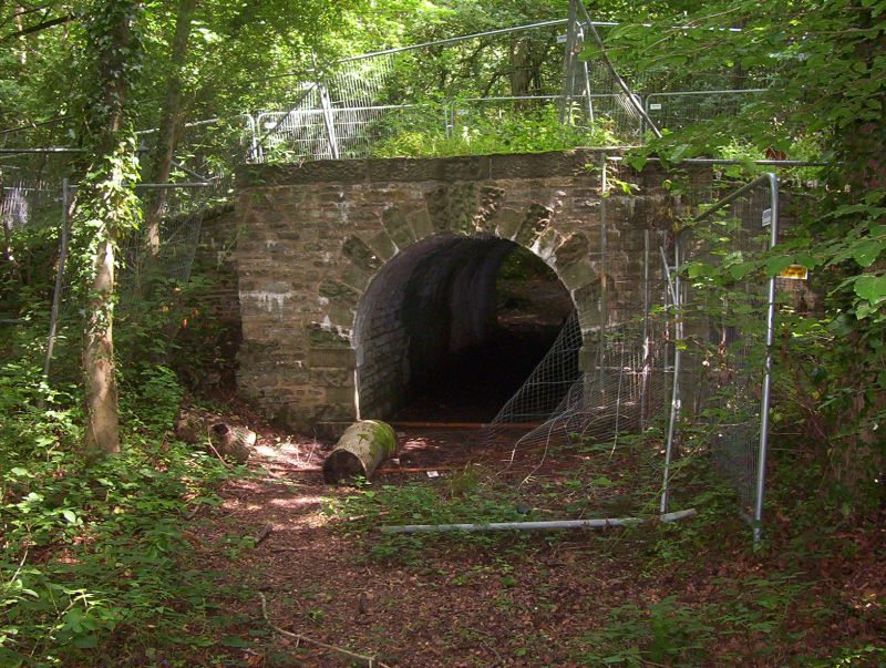
Entry Name: Arch Connecting Wood Walks from Hermitage Wood to Long Wood
Listing Date: 1 March 1991
Grade: II
Source: Historic England
Source ID: 1321118
English Heritage Legacy ID: 35054
ID on this website: 101321118
Location: Stoke Park, South Gloucestershire, BS16
County: South Gloucestershire
Civil Parish: Stoke Gifford
Built-Up Area: Filton
Traditional County: Gloucestershire
Lieutenancy Area (Ceremonial County): Gloucestershire
Church of England Parish: Stoke Gifford
Church of England Diocese: Bristol
Tagged with: Arch
The following buildings shall be added to the list
ST 67 NW STOKE GIFFORD 618776 STOKE PARK 4/24 Arch connecting wood walks from Hermitage Wood to Long Wood GV II Tunnel connecting pedestrian ways, carried under carriage way. c1750, by Thomas Wright. Limestone. A short pedestrian tunnel conecting footpaths forming part of an organised perambulation in the landscaped grounds of Stoke Park Dower House (q.v) limestone coursed vault with remains of vermiculated voussoirs and keystones to the facings, partly in situ and partly in remains on ground. Considerably overgrown at the time of inspection (July 1988). The tunnel connects Hermitage Wood and Long Wood, a carriageway passing over the top. (Stewart Harding and David Lambert: 'Saving the Wizard's Landscape', Country Life, 14-4-88, pp 132-135).
Listing NGR: ST6176877574
External links are from the relevant listing authority and, where applicable, Wikidata. Wikidata IDs may be related buildings as well as this specific building. If you want to add or update a link, you will need to do so by editing the Wikidata entry.


Other nearby listed buildings