Approximate Location Map
Large Map »
Latitude: 50.3453 / 50°20'43"N
Longitude: -5.1454 / 5°8'43"W
OS Eastings: 176310
OS Northings: 54219
OS Grid: SW763542
Mapcode National: GBR Z8.G7KB
Mapcode Global: FRA 0834.3UH
Plus Code: 9C2P8VW3+4V
Entry Name: Chimney at SW762542
Listing Date: 31 October 1988
Grade: II
Source: Historic England
Source ID: 1136821
English Heritage Legacy ID: 63691
ID on this website: 101136821
Location: Perranporth, Cornwall, TR6
County: Cornwall
Civil Parish: Perranzabuloe
Built-Up Area: Perranporth
Traditional County: Cornwall
Lieutenancy Area (Ceremonial County): Cornwall
Church of England Parish: Perranzabuloe
Church of England Diocese: Truro
Tagged with: Chimney
PERRANZABULOE BUDNICK LANE, Perranporth
SW 75 SE
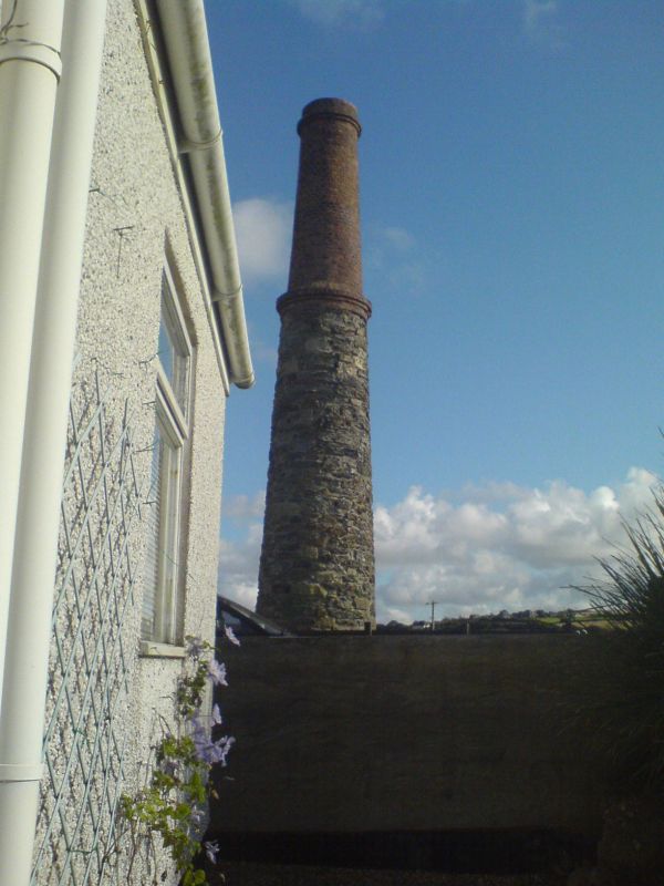
5/49 Chimney at SW762542
- II
Detached chimney associated with former mine. Circa late C19. Killas rubble to
lower stage, brick to upper stage.
Round on plan.
Tall tapered chimney. Flue opening (to north side) spanned by a round brick arch.
Brick collar dividing the stages and another collar with stepped cornice, near the top.
Listing NGR: SW7631054218
External links are from the relevant listing authority and, where applicable, Wikidata. Wikidata IDs may be related buildings as well as this specific building. If you want to add or update a link, you will need to do so by editing the Wikidata entry.


Other nearby listed buildings
