Approximate Location Map
Large Map »
Latitude: 50.3438 / 50°20'37"N
Longitude: -5.1553 / 5°9'19"W
OS Eastings: 175596
OS Northings: 54079
OS Grid: SW755540
Mapcode National: GBR Z7.4JXV
Mapcode Global: FRA 0824.CD2
Plus Code: 9C2P8RVV+GV
Entry Name: Bridge at SW755540
Listing Date: 31 October 1988
Grade: II
Source: Historic England
Source ID: 1141561
English Heritage Legacy ID: 63726
ID on this website: 101141561
Location: Perranporth, Cornwall, TR6
County: Cornwall
Civil Parish: Perranzabuloe
Built-Up Area: Perranporth
Traditional County: Cornwall
Lieutenancy Area (Ceremonial County): Cornwall
Church of England Parish: Perranzabuloe
Church of England Diocese: Truro
Tagged with: Road bridge
PERRANZABULOE PERRANPORTH
SW 75 SE
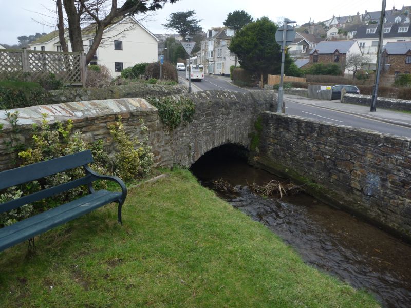
5/87 Bridge at SW755540
- II
Road bridge over stream. Circa early C19. Killas rubble.
Single-span humped-backed bridge. Segmentally-arched openings with rubble voussoirs; original stone rubble-coped stone rubble parapets.
Listing NGR: SW7559654079
External links are from the relevant listing authority and, where applicable, Wikidata. Wikidata IDs may be related buildings as well as this specific building. If you want to add or update a link, you will need to do so by editing the Wikidata entry.


Other nearby listed buildings
