Approximate Location Map
Large Map »
Latitude: 51.6088 / 51°36'31"N
Longitude: -2.5248 / 2°31'29"W
OS Eastings: 363755
OS Northings: 190121
OS Grid: ST637901
Mapcode National: GBR JT.9X6Y
Mapcode Global: VH87X.6T3L
Plus Code: 9C3VJF5G+G3
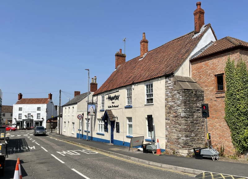
Entry Name: Plough Inn
Listing Date: 17 December 1984
Grade: II
Source: Historic England
Source ID: 1136933
English Heritage Legacy ID: 35014
Also known as: Mumtaz
ID on this website: 101136933
Location: Thornbury, South Gloucestershire, BS35
County: South Gloucestershire
Civil Parish: Thornbury
Built-Up Area: Thornbury
Traditional County: Gloucestershire
Lieutenancy Area (Ceremonial County): Gloucestershire
Church of England Parish: Thornbury St Mary
Church of England Diocese: Gloucester
Tagged with: Restaurant Inn
THORNBURY ST MARY'S STREET
4/110 (east side)
ST 6390
No 3
GV (Plough Inn)
II
Mid-late C18.
Rendered. Pantile roof. Brick stacks. Two storeys. Three windows, glazing bar
sashes. Modern windows on ground floor. Four-panel door under hood, off centre to
left.
Listing NGR: ST6375590121
External links are from the relevant listing authority and, where applicable, Wikidata. Wikidata IDs may be related buildings as well as this specific building. If you want to add or update a link, you will need to do so by editing the Wikidata entry.


Other nearby listed buildings
