Approximate Location Map
Large Map »
Latitude: 50.2113 / 50°12'40"N
Longitude: -5.4781 / 5°28'41"W
OS Eastings: 151944
OS Northings: 40375
OS Grid: SW519403
Mapcode National: GBR DXV3.X3P
Mapcode Global: VH12F.0Y9F
Plus Code: 9C2P6G6C+GQ
Entry Name: 15 and 15A, the Warren
Listing Date: 22 December 1972
Grade: II
Source: Historic England
Source ID: 1137060
English Heritage Legacy ID: 69144
ID on this website: 101137060
Location: St Ives, Cornwall, TR26
County: Cornwall
Civil Parish: St. Ives
Built-Up Area: St Ives
Traditional County: Cornwall
Lieutenancy Area (Ceremonial County): Cornwall
Church of England Parish: St Ives
Church of England Diocese: Truro
Tagged with: Building
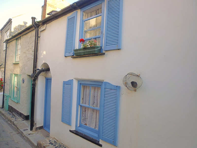
THE WARREN
1. ----------
1587 Nos 15 and 15A
SW 54 SW 1/174
II GV
2.
Early C19 cottages. Stucco and cement rendered rubble. Two storeys.
Two windows, sashes and casement. Two adjoining doors one with semi-
circular head. Slate roof. Built on rocks on the edge of the shore.
Group value.
The listed buildings from Nos 15 and 15A to The Anchorage form a group.
Listing NGR: SW5194440375
External links are from the relevant listing authority and, where applicable, Wikidata. Wikidata IDs may be related buildings as well as this specific building. If you want to add or update a link, you will need to do so by editing the Wikidata entry.


Other nearby listed buildings
