Latitude: 54.7609 / 54°45'39"N
Longitude: -2.693 / 2°41'34"W
OS Eastings: 355505
OS Northings: 540877
OS Grid: NY555408
Mapcode National: GBR 9FMD.S4
Mapcode Global: WH80S.LLVM
Plus Code: 9C6VQ864+8R
Entry Name: Wall Surrounding Churchyard of Church of St Oswald
Listing Date: 27 December 1967
Grade: II
Source: Historic England
Source ID: 1137384
English Heritage Legacy ID: 73488
ID on this website: 101137384
Location: St Oswald's Church, Kirkoswald, Westmorland and Furness, Cumbria, CA10
County: Westmorland and Furness
District: Eden
Civil Parish: Kirkoswald
Traditional County: Cumberland
Lieutenancy Area (Ceremonial County): Cumbria
Church of England Parish: Kirkoswald St Oswald
Church of England Diocese: Carlisle
Tagged with: Wall
NY 55450 40930 KIRKOSWALD KIRKOSWALD NY 54 SE
7/62 Wall surrounding churchyard of Church 27.12.67 of St Oswald
G.V. II
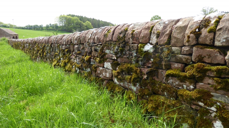
Churchyard wall. C18, C19 and early C20. Red sandstone rubble. Low wall with rounded coping stones, inscribed stones set at intervals within the wall giving the initials of those parishioners responsible for building each portion of wall. Listed partly for G.V. with Church.
Listing NGR: NY5550540877
External links are from the relevant listing authority and, where applicable, Wikidata. Wikidata IDs may be related buildings as well as this specific building. If you want to add or update a link, you will need to do so by editing the Wikidata entry.


Other nearby listed buildings