Latitude: 54.9451 / 54°56'42"N
Longitude: -3.0023 / 3°0'8"W
OS Eastings: 335893
OS Northings: 561616
OS Grid: NY358616
Mapcode National: GBR 7CG8.T4
Mapcode Global: WH7ZN.VYJX
Plus Code: 9C6RWXWX+23
Entry Name: Churchyard Cross, South of Church of St Mary
Listing Date: 1 April 1957
Grade: I
Source: Historic England
Source ID: 1138346
English Heritage Legacy ID: 77942
ID on this website: 101138346
Location: St Mary's Church, Rockcliffe, Cumberland, Cumbria, CA6
County: Cumberland
District: Carlisle
Civil Parish: Rockcliffe
Traditional County: Cumberland
Lieutenancy Area (Ceremonial County): Cumbria
Church of England Parish: Rockcliffe St Mary the Virgin
Church of England Diocese: Carlisle
Tagged with: Churchyard cross
NY 36 SE ROCKCLIFFE ROCKCLIFFE
7/151 Churchyard Cross, south of Church of St Mary
1.4.57 I
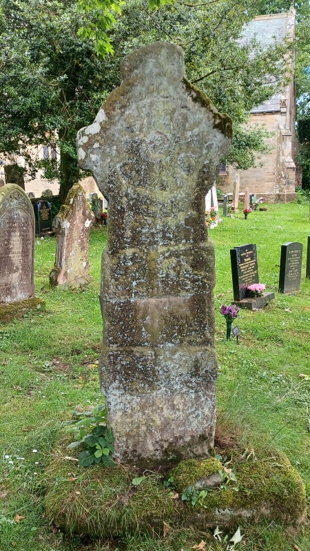
Churchyard Cross. C10 or Cll, Calciferous sandstone. Shaft has 2 broad raised bands with carved decorations of dragons and interlace; surmounted by carved wheel-head cross. Details of the design are much weathered. See, Rev Calverly, Crosses. p.257.
Listing NGR: NY3589361616
External links are from the relevant listing authority and, where applicable, Wikidata. Wikidata IDs may be related buildings as well as this specific building. If you want to add or update a link, you will need to do so by editing the Wikidata entry.


Other nearby listed buildings