Approximate Location Map
Large Map »
Latitude: 53.2821 / 53°16'55"N
Longitude: -2.0777 / 2°4'39"W
OS Eastings: 394916
OS Northings: 376124
OS Grid: SJ949761
Mapcode National: GBR FZXH.Z5
Mapcode Global: WHBBJ.1RWR
Plus Code: 9C5V7WJC+RW
Entry Name: The Old Hall
Listing Date: 14 April 1967
Grade: II
Source: Historic England
Source ID: 1138929
English Heritage Legacy ID: 58065
ID on this website: 101138929
Location: Rainow, Cheshire East, Cheshire, SK10
County: Cheshire East
Civil Parish: Rainow
Traditional County: Cheshire
Lieutenancy Area (Ceremonial County): Cheshire
Church of England Parish: Rainow Holy Trinity
Church of England Diocese: Chester
Tagged with: House
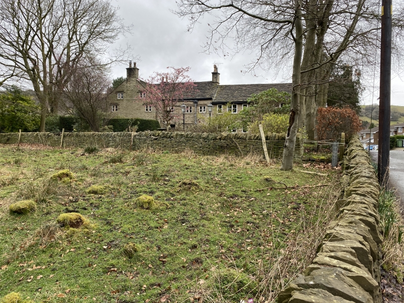
SJ 97 NW RAINOW C.P. SUGAR LANE
(South Side)
2/154 The Old Hall
14/4/1967
II
Formerly farmhouse now house: earlier C17 with addition dated 1690 and
C20 alterations. Coursed squared buff sandstone rubble. Kerridge
stone-slate roof, stone ridge and 3 stone chimneys. T-shaped in plan.
2-storey, 3-bay south front. Blocked door in right end bay under hood
mould. Other bays have C20 windows under hood moulds. Right gable
end has 4, 2-light chamfered stone mullions under hood moulds and one
left gable end has 1 similar 3-light, 3 2-lights and 2 1-lights. Wing
to rear has 2-storey, 3-bay east front. Left end bay has a heavy door
lintel with FES (for Francis Stevenson) 1690 carved on it. (A C20
copy taken from the original rainhead). A 2-light stone mullion and a
tiny leaded light to attic above. 3-light stone mullions in central
bay, 2-light in right end bay. Good rainhead is 1930 copy of the
original but some original decorated lead guttering.
Interior: Timber-framed partition walls. Dogleg C17 staircase with
shaped and pierced flat balusters, moulded handrail and square newels.
Most doors 6-panelled with reeded rails, turned handles and wooden
latches. Roof structure has 2 trusses of tiebeam, 2 diagonal struts
and a collar. 2 chamfered beams in main room with plain stops.
The continuation of the wing towards the road was rebuilt in 1975 and
is not included in the item. Formerly known as Sugar Lane Farmhouse.
Listing NGR: SJ9491676124
External links are from the relevant listing authority and, where applicable, Wikidata. Wikidata IDs may be related buildings as well as this specific building. If you want to add or update a link, you will need to do so by editing the Wikidata entry.


Other nearby listed buildings
