Approximate Location Map
Large Map »
Latitude: 54.5945 / 54°35'40"N
Longitude: -1.2936 / 1°17'37"W
OS Eastings: 445739
OS Northings: 522373
OS Grid: NZ457223
Mapcode National: GBR MHD9.QS
Mapcode Global: WHD6S.3S85
Plus Code: 9C6WHPV4+QH
Entry Name: Ruins in Garden of St Cuthbert's Vicarage
Listing Date: 21 June 1985
Grade: II
Source: Historic England
Source ID: 1139271
English Heritage Legacy ID: 59207
ID on this website: 101139271
Location: Stockton-on-Tees, North Yorkshire, TS23
County: Stockton-on-Tees
Civil Parish: Billingham
Built-Up Area: Billingham
Traditional County: Durham
Lieutenancy Area (Ceremonial County): County Durham
Church of England Parish: Billingham
Church of England Diocese: Durham
Tagged with: Architectural structure
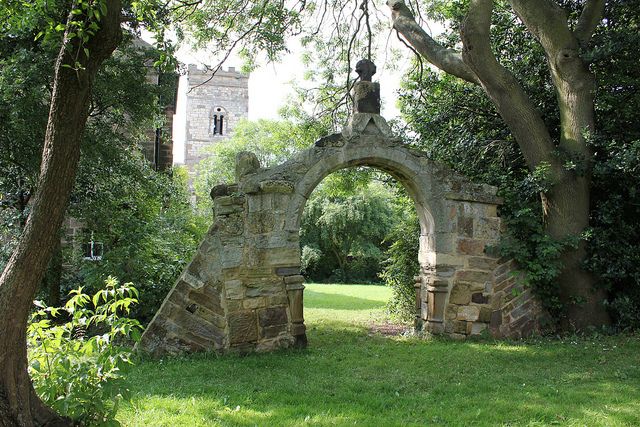
NZ 4522 BILLINGHAM CHURCH ROAD
24/423 Ruins in Garden of
St Cuthbert's Vicarage
GV II
Parts of the C17 former Church porch and C12 sedilia set up as a picturesque ruin,
Weathered ashlar masonry.
Listing NGR: NZ4573922373
External links are from the relevant listing authority and, where applicable, Wikidata. Wikidata IDs may be related buildings as well as this specific building. If you want to add or update a link, you will need to do so by editing the Wikidata entry.


Other nearby listed buildings
